Dapeng geodata
Dapeng (Guangdong) is a seat of a fourth-order administrative division; located in China in Asia/Shanghai (GMT+8) time zone. In our database, there are 1268 cities with bigger population. Compared to other cities in China, 96% of cities are located further ↑North; 51.4% of cities are located further ←West and 79.3% of cities have higher elevation than Dapeng. Note1


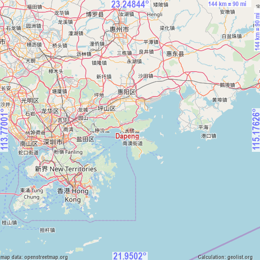
Dapeng GPS coordinates[2]
22° 36' 3.06" North, 114° 28' 23.268" East
| Map corner | latitude | longitude |
|---|---|---|
| Upper-left | 23.24844°, | 113.77001° |
| Center: | 22.60085°, | 114.47313° |
| Lower-right: | 21.9502°, | 115.17626° |
| Map W x H: | 144.4×144.4 km | = 89.7×89.7mi |
| max Lat: | 53.31946° ⇑96% North |
| Dapeng: | 22.60085° |
| min Lat: | ⇓4% South 18.22056° |
| min Long | Dapeng | max Long |
| 75.07348° | 114.47313° | 134.28917° |
| W 51.4%⇐ | ⇒48.6% E |
Elevation
Elevation of Dapeng is 28 m = 92 ft, and this is 456.8 m = 1499 ft below average elevation for this country.
| Max E: |
5622 m = 18445 ft | 79.3% |
| Avg. | 484.8 m = 1591 ft | |
| Dapeng | 28 m = 92 ft | |
Min E: |
-3 m = -10 ft | 20.7% |
See also: China elevation on elevation.city.
Geographical zone
Dapeng is located in North Torrid zone (between Equator and Tropic of Cancer). Distance of this Northern Tropic circle is 92.9 km =57.7 mi to North.| Distance of | km | miles | from Dapeng |
|---|---|---|---|
| North Pole | 7494.1 | 4656.6 | to North |
| Arctic Circle | 4888.2 | 3037.4 | to North |
| Tropic Cancer | 92.9 | 57.7 | to North |
| Equator | 2513 | 1561.5 | to South |


Nearby cities:
15 places around Dapeng: (largest is in red/bold)
• Aotou
15.3 km =9.5 mi,  24°
24°
• Danshui
22 km =13.7 mi,  358°
358°
• Haishan
27.3 km =17 mi,  259°
259°
• Kengzi
19.8 km =12.3 mi,  327°
327°
• Kuiyong
7.2 km =4.5 mi,  304°
304°
• Longcheng
28.8 km =17.9 mi,  293°
293°
• Longgang
25.5 km =15.8 mi, 302°
• Meisha
17.7 km =11 mi,  269°
269°
• Nan’ao
6.9 km =4.3 mi,  165°
165°
• Pingdi
25.8 km =16 mi,  317°
317°
• Pingshan
17.6 km =10.9 mi,  306°
306°
• Qiuchang
25 km =15.5 mi,  348°
348°
• Shatoujiao
25.9 km =16.1 mi, 258°
• Xiayong
27.5 km =17.1 mi,  40°
40°
• Yantian
24.9 km =15.5 mi, 259°
Sources, notices
• [Note1] Compared only with cities in China existing in our database
• [Src1] Map data: © OpenStreetMap contributors (CC-BY-SA)
• [Src2] Other city data from geonames.org with taken over terms of usage.
• [Src3] Geographical zone / Annual Mean Temperature by Robert A. Rohde @ Wikipedia
