Xiaoshajiang geodata
Xiaoshajiang (Hunan) is a seat of a fourth-order administrative division; located in China in Asia/Shanghai (GMT+8) time zone. With population of 2,160 people, there are 1014 cities with bigger population in this country. Compared to other cities in China, 76.5% of cities are located further ↑North; 68.1% of cities are located further →East and 89.7% of cities have lower elevation than Xiaoshajiang. Note1


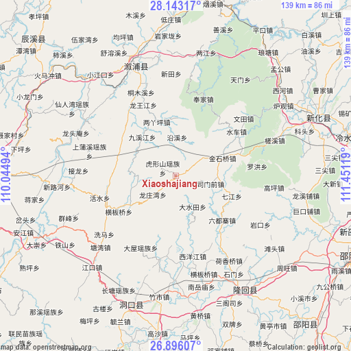
Xiaoshajiang GPS coordinates[2]
27° 31' 17.004" North, 110° 44' 53.016" East
| Map corner | latitude | longitude |
|---|---|---|
| Upper-left | 28.14317°, | 110.04494° |
| Center: | 27.52139°, | 110.74806° |
| Lower-right: | 26.89607°, | 111.45119° |
| Map W x H: | 138.7×138.7 km | = 86.2×86.2mi |
| max Lat: | 53.31946° ⇑76.5% North |
| Xiaoshajiang: | 27.52139° |
| min Lat: | ⇓23.5% South 18.22056° |
| min Long | Xiaoshajiang | max Long |
| 75.07348° | 110.74806° | 134.28917° |
| W 31.9%⇐ | ⇒68.1% E |
Elevation
Elevation of Xiaoshajiang is 1333 m = 4373 ft, and this is 848.2 m = 2783 ft above average elevation for this country.
| Max E: |
5622 m = 18445 ft | 10.3% |
| Xiaoshajiang | 1333 m 4373 ft | |
| Avg. | 484.8 m = 1591 ft | |
Min E: |
-3 m = -10 ft | 89.7% |
See also: China elevation on elevation.city.
Geographical zone
Xiaoshajiang is located in North temperate zone (between Tropic of Cancer and the Arctic Circle). Distance of this Northern Tropic circle is 454.2 km =282.2 mi to South.| Distance of | km | miles | from Xiaoshajiang |
|---|---|---|---|
| North Pole | 6947 | 4316.7 | to North |
| Arctic Circle | 4341.1 | 2697.4 | to North |
| Tropic Cancer | 454.2 | 282.2 | to South |
| Equator | 3060.1 | 1901.5 | to South |


Nearby cities:
15 places around Xiaoshajiang: (largest is in red/bold)
• Dashuitian
13.8 km =8.6 mi,  151°
151°
• Huangjinjing
15.8 km =9.8 mi,  63°
63°
• Huxingshan
5.9 km =3.7 mi,  301°
301°
• Jinshiqiao
19.8 km =12.3 mi,  69°
69°
• Jiuxijiang
20 km =12.4 mi,  318°
318°
• Liangyaping
23.2 km =14.4 mi,  340°
340°
• Liuduzhai
25.3 km =15.7 mi,  133°
133°
• Longtan
24.2 km =15 mi,  239°
239°
• Matangshan
15.8 km =9.8 mi,  200°
200°
• Qijiang
23.6 km =14.7 mi,  109°
109°
• Simenqian
14.1 km =8.8 mi, 105°
• Xiaohenglong
24.6 km =15.3 mi,  292°
292°
• Xixi
27.9 km =17.3 mi,  46°
46°
• Yanggu’ao
19.7 km =12.2 mi,  101°
101°
• Yatian
27.4 km =17 mi, 73°
Sources, notices
• [Note1] Compared only with cities in China existing in our database
• [Src1] Map data: © OpenStreetMap contributors (CC-BY-SA)
• [Src2] Other city data from geonames.org with taken over terms of usage.
• [Src3] Geographical zone / Annual Mean Temperature by Robert A. Rohde @ Wikipedia
