Xiaonangou geodata
Xiaonangou (Gansu) is a seat of a fourth-order administrative division; located in China in Asia/Shanghai (GMT+8) time zone. In our database, there are 1268 cities with bigger population. Compared to other cities in China, 78.4% of cities are located further ↓South; 84.2% of cities are located further →East and 93.5% of cities have lower elevation than Xiaonangou. Note1


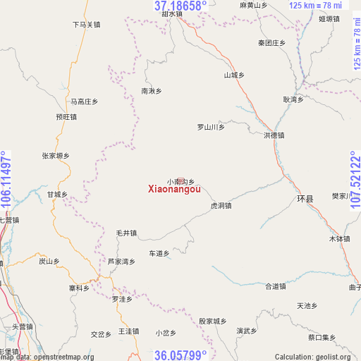
Xiaonangou GPS coordinates[2]
36° 37' 27.66" North, 106° 49' 5.124" East
| Map corner | latitude | longitude |
|---|---|---|
| Upper-left | 37.18658°, | 106.11497° |
| Center: | 36.62435°, | 106.81809° |
| Lower-right: | 36.05799°, | 107.52122° |
| Map W x H: | 125.5×125.5 km | = 78×78mi |
| max Lat: | 53.31946° ⇑21.6% North |
| Xiaonangou: | 36.62435° |
| min Lat: | ⇓78.4% South 18.22056° |
| min Long | Xiaonangou | max Long |
| 75.07348° | 106.81809° | 134.28917° |
| W 15.8%⇐ | ⇒84.2% E |
Elevation
Elevation of Xiaonangou is 1798 m = 5899 ft, and this is 1313.2 m = 4308 ft above average elevation for this country.
| Max E: |
5622 m = 18445 ft | 6.5% |
| Xiaonangou | 1798 m 5899 ft | |
| Avg. | 484.8 m = 1591 ft | |
Min E: |
-3 m = -10 ft | 93.5% |
See also: China elevation on elevation.city.
Geographical zone
Xiaonangou is located in North temperate zone (between Tropic of Cancer and the Arctic Circle). Distance of this Northern Tropic circle is 1466.3 km =911.1 mi to South.| Distance of | km | miles | from Xiaonangou |
|---|---|---|---|
| North Pole | 5934.8 | 3687.7 | to North |
| Arctic Circle | 3328.9 | 2068.5 | to North |
| Tropic Cancer | 1466.3 | 911.1 | to South |
| Equator | 4072.2 | 2530.3 | to South |


Nearby cities:
15 places around Xiaonangou: (largest is in red/bold)
• Chedao
25.9 km =16.1 mi,  196°
196°
• Gancheng
42.9 km =26.7 mi,  265°
265°
• Heping
41.8 km =26 mi,  140°
140°
• Hongde
35.2 km =21.9 mi,  68°
68°
• Huancheng
43 km =26.7 mi,  97°
97°
• Hudong
16.1 km =10 mi,  121°
121°
• Lujiawan
34.8 km =21.6 mi,  217°
217°
• Luoshanchuan
22.3 km =13.9 mi,  31°
31°
• Luping
36.8 km =22.9 mi, 144°
• Maojing
25.9 km =16.1 mi,  226°
226°
• Maqu
40.3 km =25 mi, 230°
• Nanqiu
31.7 km =19.7 mi,  344°
344°
• Shancheng
41.4 km =25.7 mi, 26°
• Xichuan
32.9 km =20.4 mi, 115°
• Yuanmao
21 km =13 mi, 199°
Sources, notices
• [Note1] Compared only with cities in China existing in our database
• [Src1] Map data: © OpenStreetMap contributors (CC-BY-SA)
• [Src2] Other city data from geonames.org with taken over terms of usage.
• [Src3] Geographical zone / Annual Mean Temperature by Robert A. Rohde @ Wikipedia
