Xiaojiang geodata
Xiaojiang (Guangxi) is a seat of a third-order administrative division; located in China in Asia/Shanghai (GMT+8) time zone. In our database, there are 1268 cities with bigger population. Compared to other cities in China, 96.8% of cities are located further ↑North; 73.6% of cities are located further →East and 63.7% of cities have higher elevation than Xiaojiang. Note1


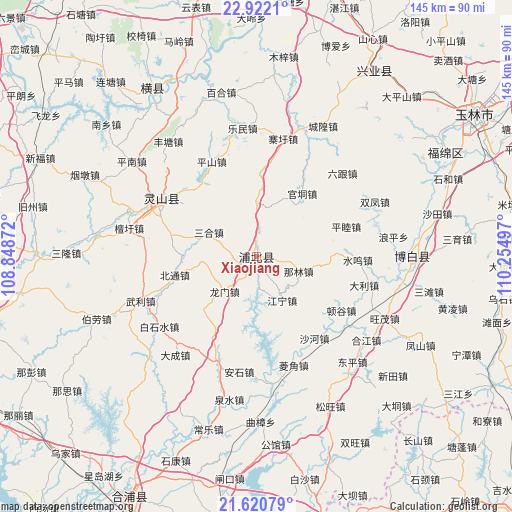
Xiaojiang GPS coordinates[2]
22° 16' 22.656" North, 109° 33' 6.624" East
| Map corner | latitude | longitude |
|---|---|---|
| Upper-left | 22.9221°, | 108.84872° |
| Center: | 22.27296°, | 109.55184° |
| Lower-right: | 21.62079°, | 110.25497° |
| Map W x H: | 144.7×144.7 km | = 89.9×89.9mi |
| max Lat: | 53.31946° ⇑96.8% North |
| Xiaojiang: | 22.27296° |
| min Lat: | ⇓3.2% South 18.22056° |
| min Long | Xiaojiang | max Long |
| 75.07348° | 109.55184° | 134.28917° |
| W 26.4%⇐ | ⇒73.6% E |
Elevation
Elevation of Xiaojiang is 79 m = 259 ft, and this is 405.8 m = 1331 ft below average elevation for this country.
| Max E: |
5622 m = 18445 ft | 63.7% |
| Avg. | 484.8 m = 1591 ft | |
| Xiaojiang | 79 m = 259 ft | |
Min E: |
-3 m = -10 ft | 36.3% |
See also: China elevation on elevation.city.
Geographical zone
Xiaojiang is located in North Torrid zone (between Equator and Tropic of Cancer). Distance of this Northern Tropic circle is 129.4 km =80.4 mi to North.| Distance of | km | miles | from Xiaojiang |
|---|---|---|---|
| North Pole | 7530.5 | 4679.2 | to North |
| Arctic Circle | 4924.7 | 3060.1 | to North |
| Tropic Cancer | 129.4 | 80.4 | to North |
| Equator | 2476.5 | 1538.8 | to South |


Nearby cities:
15 places around Xiaojiang: (largest is in red/bold)
• Bobai
43.5 km =27 mi,  90°
90°
• Changshan
70.7 km =43.9 mi,  138°
138°
• Gaoqiao
77 km =47.8 mi,  163°
163°
• Heliao
80.4 km =50 mi,  125°
125°
• Hengzhou
54.8 km =34.1 mi,  327°
327°
• Lianzhou
76.5 km =47.5 mi,  208°
208°
• Lingcheng
31.4 km =19.5 mi,  302°
302°
• Qiaoxu
78.9 km =49 mi,  15°
15°
• Qingping
81.4 km =50.6 mi,  152°
152°
• Shijing
80.3 km =49.9 mi, 142°
• Shinan
62 km =38.5 mi,  32°
32°
• Tangpeng
78.5 km =48.8 mi, 132°
• Wenquan
72.6 km =45.1 mi, 85°
• Yashan
41 km =25.5 mi,  101°
101°
• Yulin
73.4 km =45.6 mi,  56°
56°
Sources, notices
• [Note1] Compared only with cities in China existing in our database
• [Src1] Map data: © OpenStreetMap contributors (CC-BY-SA)
• [Src2] Other city data from geonames.org with taken over terms of usage.
• [Src3] Geographical zone / Annual Mean Temperature by Robert A. Rohde @ Wikipedia
