Xiaogan geodata
Xiaogan (Hubei) is a seat of a second-order administrative division; located in China in Asia/Shanghai (GMT+8) time zone. With population of 160,437 people, there are 273 cities with bigger population in this country. Compared to other cities in China, 54.2% of cities are located further ↓South; 51.9% of cities are located further →East and 75.7% of cities have higher elevation than Xiaogan. Note1


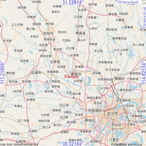
Xiaogan GPS coordinates[2]
30° 55' 36.804" North, 113° 55' 19.956" East
| Map corner | latitude | longitude |
|---|---|---|
| Upper-left | 31.52814°, | 113.21909° |
| Center: | 30.92689°, | 113.92221° |
| Lower-right: | 30.32184°, | 114.62534° |
| Map W x H: | 134.1×134.1 km | = 83.3×83.3mi |
| max Lat: | 53.31946° ⇑45.8% North |
| Xiaogan: | 30.92689° |
| min Lat: | ⇓54.2% South 18.22056° |
| min Long | Xiaogan | max Long |
| 75.07348° | 113.92221° | 134.28917° |
| W 48.1%⇐ | ⇒51.9% E |
Elevation
Elevation of Xiaogan is 35 m = 115 ft, and this is 449.8 m = 1476 ft below average elevation for this country.
| Max E: |
5622 m = 18445 ft | 75.7% |
| Avg. | 484.8 m = 1591 ft | |
| Xiaogan | 35 m = 115 ft | |
Min E: |
-3 m = -10 ft | 24.3% |
See also: Xiaogan elevation on elevation.city.
Geographical zone
Xiaogan is located in North temperate zone (between Tropic of Cancer and the Arctic Circle). Distance of this Northern Tropic circle is 832.8 km =517.5 mi to South.| Distance of | km | miles | from Xiaogan |
|---|---|---|---|
| North Pole | 6568.3 | 4081.4 | to North |
| Arctic Circle | 3962.4 | 2462.1 | to North |
| Tropic Cancer | 832.8 | 517.5 | to South |
| Equator | 3438.7 | 2136.7 | to South |


Nearby cities:
15 places around Xiaogan: (largest is in red/bold)
• Chezhan
2.7 km =1.7 mi,  357°
357°
• Dougang
14.3 km =8.9 mi,  331°
331°
• Guangchang
0.9 km =0.6 mi,  252°
252°
• Huzhen
15.4 km =9.6 mi, 254°
• Maochen
8.2 km =5.1 mi,  147°
147°
• Pengxing
4.4 km =2.7 mi,  347°
347°
• Sancha
13.2 km =8.2 mi,  81°
81°
• Shahe
9.5 km =5.9 mi,  275°
275°
• Shuyuan
2.2 km =1.4 mi, 253°
• Wolong
3.5 km =2.2 mi,  227°
227°
• Wuluo
12.7 km =7.9 mi,  299°
299°
• Xiaxindian
13.2 km =8.2 mi,  218°
218°
• Xihe
12.3 km =7.6 mi,  42°
42°
• Xinhua
1.8 km =1.1 mi, 223°
• Xinpu
8.3 km =5.2 mi, 41°
Sources, notices
• [Note1] Compared only with cities in China existing in our database
• [Src1] Map data: © OpenStreetMap contributors (CC-BY-SA)
• [Src2] Other city data from geonames.org with taken over terms of usage.
• [Src3] Geographical zone / Annual Mean Temperature by Robert A. Rohde @ Wikipedia
