Xianyan geodata
Xianyan (Zhejiang) is a seat of a fourth-order administrative division; located in China in Asia/Shanghai (GMT+8) time zone. In our database, there are 1268 cities with bigger population. Compared to other cities in China, 57.8% of cities are located further ↑North; 86.9% of cities are located further ←West and 70.8% of cities have higher elevation than Xianyan. Note1


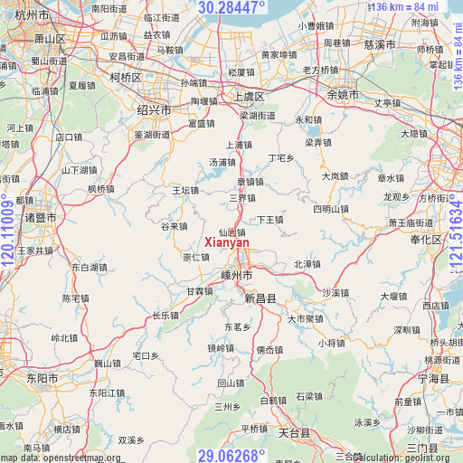
Xianyan GPS coordinates[2]
29° 40' 31.548" North, 120° 48' 47.556" East
| Map corner | latitude | longitude |
|---|---|---|
| Upper-left | 30.28447°, | 120.11009° |
| Center: | 29.67543°, | 120.81321° |
| Lower-right: | 29.06268°, | 121.51634° |
| Map W x H: | 135.9×135.9 km | = 84.4×84.4mi |
| max Lat: | 53.31946° ⇑57.8% North |
| Xianyan: | 29.67543° |
| min Lat: | ⇓42.2% South 18.22056° |
| min Long | Xianyan | max Long |
| 75.07348° | 120.81321° | 134.28917° |
| W 86.9%⇐ | ⇒13.1% E |
Elevation
Elevation of Xianyan is 49 m = 161 ft, and this is 435.8 m = 1430 ft below average elevation for this country.
| Max E: |
5622 m = 18445 ft | 70.8% |
| Avg. | 484.8 m = 1591 ft | |
| Xianyan | 49 m = 161 ft | |
Min E: |
-3 m = -10 ft | 29.2% |
See also: China elevation on elevation.city.
Geographical zone
Xianyan is located in North temperate zone (between Tropic of Cancer and the Arctic Circle). Distance of this Northern Tropic circle is 693.7 km =431 mi to South.| Distance of | km | miles | from Xianyan |
|---|---|---|---|
| North Pole | 6707.5 | 4167.8 | to North |
| Arctic Circle | 4101.6 | 2548.6 | to North |
| Tropic Cancer | 693.7 | 431 | to South |
| Equator | 3299.6 | 2050.3 | to South |


Nearby cities:
15 places around Xianyan: (largest is in red/bold)
• Chongren
12.8 km =8 mi,  234°
234°
• Ganlin
19.7 km =12.2 mi,  209°
209°
• Gulai
16.6 km =10.3 mi,  275°
275°
• Huangze
15.1 km =9.4 mi,  135°
135°
• Meizhu
22.1 km =13.7 mi,  183°
183°
• Pukou
6.4 km =4 mi, 139°
• Ruanzhuang
23.8 km =14.8 mi,  60°
60°
• Sanjie
9.9 km =6.2 mi,  19°
19°
• Shanhu
8.9 km =5.5 mi, 177°
• Shihuang
21.7 km =13.5 mi, 225°
• Tangpu
20.8 km =12.9 mi,  352°
352°
• Wangtan
18.4 km =11.4 mi,  312°
312°
• Xiaren
23.7 km =14.7 mi,  119°
119°
• Xinchang Chengguanzhen
20.7 km =12.9 mi,  156°
156°
• Zhangzhen
15.8 km =9.8 mi, 19°
Sources, notices
• [Note1] Compared only with cities in China existing in our database
• [Src1] Map data: © OpenStreetMap contributors (CC-BY-SA)
• [Src2] Other city data from geonames.org with taken over terms of usage.
• [Src3] Geographical zone / Annual Mean Temperature by Robert A. Rohde @ Wikipedia
