Xiantan geodata
Xiantan (Sichuan) is a populated place; located in China in Asia/Shanghai (GMT+8) time zone. With population of 1,100 people, there are 1155 cities with bigger population in this country. Compared to other cities in China, 67% of cities are located further ↑North; 86.2% of cities are located further →East and 64.5% of cities have lower elevation than Xiantan. Note1


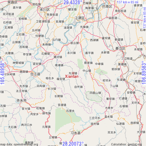
Xiantan GPS coordinates[2]
28° 49' 6.924" North, 106° 11' 33.72" East
| Map corner | latitude | longitude |
|---|---|---|
| Upper-left | 29.4328°, | 105.48958° |
| Center: | 28.81859°, | 106.1927° |
| Lower-right: | 28.20073°, | 106.89583° |
| Map W x H: | 137×137 km | = 85.1×85.1mi |
| max Lat: | 53.31946° ⇑67% North |
| Xiantan: | 28.81859° |
| min Lat: | ⇓33% South 18.22056° |
| min Long | Xiantan | max Long |
| 75.07348° | 106.1927° | 134.28917° |
| W 13.8%⇐ | ⇒86.2% E |
Elevation
Elevation of Xiantan is 317 m = 1040 ft, and this is 167.8 m = 551 ft below average elevation for this country.
| Max E: |
5622 m = 18445 ft | 35.5% |
| Avg. | 484.8 m = 1591 ft | |
| Xiantan | 317 m = 1040 ft | |
Min E: |
-3 m = -10 ft | 64.5% |
See also: China elevation on elevation.city.
Geographical zone
Xiantan is located in North temperate zone (between Tropic of Cancer and the Arctic Circle). Distance of this Northern Tropic circle is 598.4 km =371.8 mi to South.| Distance of | km | miles | from Xiantan |
|---|---|---|---|
| North Pole | 6802.7 | 4227 | to North |
| Arctic Circle | 4196.8 | 2607.8 | to North |
| Tropic Cancer | 598.4 | 371.8 | to South |
| Equator | 3204.3 | 1991.1 | to South |


Nearby cities:
15 places around Xiantan: (largest is in red/bold)
• Bailin
27.7 km =17.2 mi,  109°
109°
• Baisha
28 km =17.4 mi,  345°
345°
• Caijia
17.5 km =10.9 mi,  55°
55°
• Changqi
25.2 km =15.7 mi,  208°
208°
• Changsha
24.6 km =15.3 mi,  233°
233°
• Ciyun
28.6 km =17.8 mi,  2°
2°
• Fubao
12.6 km =7.8 mi,  244°
244°
• Guandu
29.2 km =18.1 mi,  197°
197°
• Hejiang
35 km =21.7 mi,  268°
268°
• Lishi
29.7 km =18.5 mi,  13°
13°
• Shima
32.2 km =20 mi,  305°
305°
• Shimen
35 km =21.7 mi,  333°
333°
• Yongxin
37 km =23 mi, 63°
• Yongxing
19.1 km =11.9 mi,  355°
355°
• Zhuyang
36.4 km =22.6 mi,  318°
318°
Sources, notices
• [Note1] Compared only with cities in China existing in our database
• [Src1] Map data: © OpenStreetMap contributors (CC-BY-SA)
• [Src2] Other city data from geonames.org with taken over terms of usage.
• [Src3] Geographical zone / Annual Mean Temperature by Robert A. Rohde @ Wikipedia
