Wuqiao geodata
Wuqiao (Jiangxi) is a seat of a fourth-order administrative division; located in China in Asia/Shanghai (GMT+8) time zone. In our database, there are 1268 cities with bigger population. Compared to other cities in China, 69% of cities are located further ↑North; 55.6% of cities are located further ←West and 64.3% of cities have higher elevation than Wuqiao. Note1


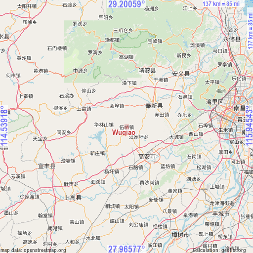
Wuqiao GPS coordinates[2]
28° 35' 5.964" North, 115° 14' 32.28" East
| Map corner | latitude | longitude |
|---|---|---|
| Upper-left | 29.20059°, | 114.53918° |
| Center: | 28.58499°, | 115.2423° |
| Lower-right: | 27.96577°, | 115.94543° |
| Map W x H: | 137.3×137.3 km | = 85.3×85.3mi |
| max Lat: | 53.31946° ⇑69% North |
| Wuqiao: | 28.58499° |
| min Lat: | ⇓31% South 18.22056° |
| min Long | Wuqiao | max Long |
| 75.07348° | 115.2423° | 134.28917° |
| W 55.6%⇐ | ⇒44.4% E |
Elevation
Elevation of Wuqiao is 76 m = 249 ft, and this is 408.8 m = 1341 ft below average elevation for this country.
| Max E: |
5622 m = 18445 ft | 64.3% |
| Avg. | 484.8 m = 1591 ft | |
| Wuqiao | 76 m = 249 ft | |
Min E: |
-3 m = -10 ft | 35.7% |
See also: China elevation on elevation.city.
Geographical zone
Wuqiao is located in North temperate zone (between Tropic of Cancer and the Arctic Circle). Distance of this Northern Tropic circle is 572.4 km =355.7 mi to South.| Distance of | km | miles | from Wuqiao |
|---|---|---|---|
| North Pole | 6828.7 | 4243.2 | to North |
| Arctic Circle | 4222.8 | 2623.9 | to North |
| Tropic Cancer | 572.4 | 355.7 | to South |
| Equator | 3178.4 | 1975 | to South |


Nearby cities:
15 places around Wuqiao: (largest is in red/bold)
• Chi’an
17.2 km =10.7 mi,  46°
46°
• Cunqian
16.8 km =10.4 mi,  220°
220°
• Dacheng
27.5 km =17.1 mi,  100°
100°
• Fengchuan
18.8 km =11.7 mi, 47°
• Huibu
16.7 km =10.4 mi,  339°
339°
• Junyang
22.3 km =13.9 mi,  147°
147°
• Longtan
21.4 km =13.3 mi,  181°
181°
• Luoshi
20.3 km =12.6 mi,  302°
302°
• Shangfu
25.3 km =15.7 mi,  293°
293°
• Shanghu
27.8 km =17.3 mi,  162°
162°
• Shinao
22.1 km =13.7 mi,  167°
167°
• Wangjiaxu
8.3 km =5.2 mi,  128°
128°
• Xiangfu
22.1 km =13.7 mi,  123°
123°
• Xinzhuang
21.2 km =13.2 mi,  228°
228°
• Yangxu
25.4 km =15.8 mi,  198°
198°
Sources, notices
• [Note1] Compared only with cities in China existing in our database
• [Src1] Map data: © OpenStreetMap contributors (CC-BY-SA)
• [Src2] Other city data from geonames.org with taken over terms of usage.
• [Src3] Geographical zone / Annual Mean Temperature by Robert A. Rohde @ Wikipedia
