Wangzhuangbu geodata
Wangzhuangbu (Shanxi) is a seat of a fourth-order administrative division; located in China in Asia/Shanghai (GMT+8) time zone. In our database, there are 1268 cities with bigger population. Compared to other cities in China, 84.4% of cities are located further ↓South; 52% of cities are located further →East and 87.5% of cities have lower elevation than Wangzhuangbu. Note1


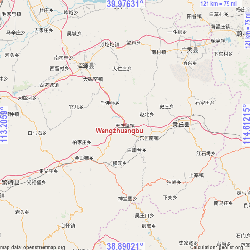
Wangzhuangbu GPS coordinates[2]
39° 26' 7.368" North, 113° 54' 32.472" East
| Map corner | latitude | longitude |
|---|---|---|
| Upper-left | 39.97631°, | 113.2059° |
| Center: | 39.43538°, | 113.90902° |
| Lower-right: | 38.89021°, | 114.61215° |
| Map W x H: | 120.8×120.8 km | = 75.1×75.1mi |
| max Lat: | 53.31946° ⇑15.6% North |
| Wangzhuangbu: | 39.43538° |
| min Lat: | ⇓84.4% South 18.22056° |
| min Long | Wangzhuangbu | max Long |
| 75.07348° | 113.90902° | 134.28917° |
| W 48%⇐ | ⇒52% E |
Elevation
Elevation of Wangzhuangbu is 1151 m = 3776 ft, and this is 666.2 m = 2186 ft above average elevation for this country.
| Max E: |
5622 m = 18445 ft | 12.5% |
| Wangzhuangbu | 1151 m 3776 ft | |
| Avg. | 484.8 m = 1591 ft | |
Min E: |
-3 m = -10 ft | 87.5% |
See also: China elevation on elevation.city.
Geographical zone
Wangzhuangbu is located in North temperate zone (between Tropic of Cancer and the Arctic Circle). Distance of this Northern Tropic circle is 1778.9 km =1105.4 mi to South.| Distance of | km | miles | from Wangzhuangbu |
|---|---|---|---|
| North Pole | 5622.3 | 3493.5 | to North |
| Arctic Circle | 3016.4 | 1874.3 | to North |
| Tropic Cancer | 1778.9 | 1105.4 | to South |
| Equator | 4384.8 | 2724.6 | to South |


Nearby cities:
15 places around Wangzhuangbu: (largest is in red/bold)
• Baijiazhuang
22.3 km =13.9 mi,  249°
249°
• Baiyatai
13.2 km =8.2 mi,  155°
155°
• Daciyao
27.3 km =17 mi,  325°
325°
• Darenzhuang
27.7 km =17.2 mi,  356°
356°
• Daying
20.7 km =12.9 mi,  218°
218°
• Donghenan
13 km =8.1 mi,  117°
117°
• Guan’er
25.1 km =15.6 mi,  290°
290°
• Hengjian
18.2 km =11.3 mi,  187°
187°
• Huanghuatan
24.9 km =15.5 mi,  346°
346°
• Jinshanpu
25.2 km =15.7 mi,  231°
231°
• Qianfoling
13.2 km =8.2 mi, 326°
• Qingciyao
23.8 km =14.8 mi, 329°
• Wuling
20.9 km =13 mi,  79°
79°
• Yong’an
34.6 km =21.5 mi, 326°
• Zhaobei
11.9 km =7.4 mi,  62°
62°
Sources, notices
• [Note1] Compared only with cities in China existing in our database
• [Src1] Map data: © OpenStreetMap contributors (CC-BY-SA)
• [Src2] Other city data from geonames.org with taken over terms of usage.
• [Src3] Geographical zone / Annual Mean Temperature by Robert A. Rohde @ Wikipedia
