Yong’an geodata
Yong’an (Shanxi) is a seat of a third-order administrative division; located in China in Asia/Shanghai (GMT+8) time zone. In our database, there are 1268 cities with bigger population. Compared to other cities in China, 85.3% of cities are located further ↓South; 53.1% of cities are located further →East and 86.6% of cities have lower elevation than Yong’an. Note1


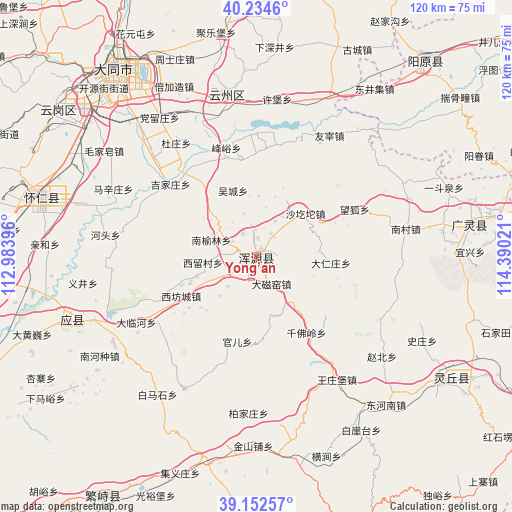
Yong’an GPS coordinates[2]
39° 41' 44.556" North, 113° 41' 13.488" East
| Map corner | latitude | longitude |
|---|---|---|
| Upper-left | 40.2346°, | 112.98396° |
| Center: | 39.69571°, | 113.68708° |
| Lower-right: | 39.15257°, | 114.39021° |
| Map W x H: | 120.3×120.3 km | = 74.8×74.8mi |
| max Lat: | 53.31946° ⇑14.7% North |
| Yong’an: | 39.69571° |
| min Lat: | ⇓85.3% South 18.22056° |
| min Long | Yong’an | max Long |
| 75.07348° | 113.68708° | 134.28917° |
| W 46.9%⇐ | ⇒53.1% E |
Elevation
Elevation of Yong’an is 1093 m = 3586 ft, and this is 608.2 m = 1995 ft above average elevation for this country.
| Max E: |
5622 m = 18445 ft | 13.4% |
| Yong’an | 1093 m 3586 ft | |
| Avg. | 484.8 m = 1591 ft | |
Min E: |
-3 m = -10 ft | 86.6% |
See also: China elevation on elevation.city.
Geographical zone
Yong’an is located in North temperate zone (between Tropic of Cancer and the Arctic Circle). Distance of this Northern Tropic circle is 1807.8 km =1123.3 mi to South.| Distance of | km | miles | from Yong’an |
|---|---|---|---|
| North Pole | 5593.3 | 3475.5 | to North |
| Arctic Circle | 2987.4 | 1856.3 | to North |
| Tropic Cancer | 1807.8 | 1123.3 | to South |
| Equator | 4413.7 | 2742.5 | to South |


Nearby cities:
15 places around Yong’an: (largest is in red/bold)
• Caicun
6.3 km =3.9 mi,  328°
328°
• Daciyao
7.4 km =4.6 mi,  150°
150°
• Darenzhuang
17.4 km =10.8 mi,  94°
94°
• Guan’er
20.5 km =12.7 mi,  192°
192°
• Huanghuatan
14.1 km =8.8 mi,  109°
109°
• Nanyulin
11.5 km =7.1 mi,  296°
296°
• Qianfoling
21.5 km =13.4 mi, 146°
• Qingciyao
10.9 km =6.8 mi,  140°
140°
• Tuofeng
22.2 km =13.8 mi,  247°
247°
• Wanghu
25.7 km =16 mi,  64°
64°
• Wucheng
16.4 km =10.2 mi,  340°
340°
• Xiahan
7 km =4.3 mi, 297°
• Xifangcheng
19.9 km =12.4 mi,  242°
242°
• Xiliu
12.6 km =7.8 mi,  263°
263°
• Xinpeicun
16.1 km =10 mi, 237°
Sources, notices
• [Note1] Compared only with cities in China existing in our database
• [Src1] Map data: © OpenStreetMap contributors (CC-BY-SA)
• [Src2] Other city data from geonames.org with taken over terms of usage.
• [Src3] Geographical zone / Annual Mean Temperature by Robert A. Rohde @ Wikipedia
