Tucheng geodata
Tucheng (Hubei) is a seat of a fourth-order administrative division; located in China in Asia/Shanghai (GMT+8) time zone. In our database, there are 1268 cities with bigger population. Compared to other cities in China, 62.8% of cities are located further ↓South; 68.3% of cities are located further →East and 78.9% of cities have lower elevation than Tucheng. Note1


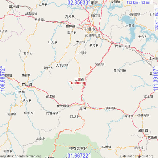
Tucheng GPS coordinates[2]
32° 15' 49.392" North, 110° 41' 19.824" East
| Map corner | latitude | longitude |
|---|---|---|
| Upper-left | 32.85633°, | 109.98572° |
| Center: | 32.26372°, | 110.68884° |
| Lower-right: | 31.66722°, | 111.39197° |
| Map W x H: | 132.2×132.2 km | = 82.1×82.1mi |
| max Lat: | 53.31946° ⇑37.2% North |
| Tucheng: | 32.26372° |
| min Lat: | ⇓62.8% South 18.22056° |
| min Long | Tucheng | max Long |
| 75.07348° | 110.68884° | 134.28917° |
| W 31.7%⇐ | ⇒68.3% E |
Elevation
Elevation of Tucheng is 650 m = 2133 ft, and this is 165.2 m = 542 ft above average elevation for this country.
| Max E: |
5622 m = 18445 ft | 21.1% |
| Tucheng | 650 m 2133 ft | |
| Avg. | 484.8 m = 1591 ft | |
Min E: |
-3 m = -10 ft | 78.9% |
See also: China elevation on elevation.city.
Geographical zone
Tucheng is located in North temperate zone (between Tropic of Cancer and the Arctic Circle). Distance of this Northern Tropic circle is 981.5 km =609.9 mi to South.| Distance of | km | miles | from Tucheng |
|---|---|---|---|
| North Pole | 6419.7 | 3989 | to North |
| Arctic Circle | 3813.8 | 2369.8 | to North |
| Tropic Cancer | 981.5 | 609.9 | to South |
| Equator | 3587.4 | 2229.1 | to South |


Nearby cities:
15 places around Tucheng: (largest is in red/bold)
• Bailang
38.7 km =24 mi,  28°
28°
• Dachuan
31.2 km =19.4 mi,  2°
2°
• Eryan
40.6 km =25.2 mi,  11°
11°
• Fangxian Chengguanzhen
23.6 km =14.7 mi,  169°
169°
• Guanshan
20.3 km =12.6 mi,  53°
53°
• Hualongyan
26.2 km =16.3 mi,  211°
211°
• Jundian
23.9 km =14.9 mi,  196°
196°
• Liuliping
40.7 km =25.3 mi,  42°
42°
• Maota
31 km =19.3 mi,  23°
23°
• Mengusi
36.2 km =22.5 mi,  218°
218°
• Qingfeng
35.7 km =22.2 mi,  132°
132°
• Wudanglu
37.9 km =23.5 mi, 15°
• Xigou
39.3 km =24.4 mi,  350°
350°
• Yanchihe
34.8 km =21.6 mi,  77°
77°
• Yeda
38 km =23.6 mi,  324°
324°
Sources, notices
• [Note1] Compared only with cities in China existing in our database
• [Src1] Map data: © OpenStreetMap contributors (CC-BY-SA)
• [Src2] Other city data from geonames.org with taken over terms of usage.
• [Src3] Geographical zone / Annual Mean Temperature by Robert A. Rohde @ Wikipedia
