Guanshan geodata
Guanshan (Hubei) is a seat of a fourth-order administrative division; located in China in Asia/Shanghai (GMT+8) time zone. In our database, there are 1268 cities with bigger population. Compared to other cities in China, 63.5% of cities are located further ↓South; 67.6% of cities are located further →East and 65.2% of cities have lower elevation than Guanshan. Note1


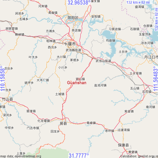
Guanshan GPS coordinates[2]
32° 22' 24.564" North, 110° 51' 42.12" East
| Map corner | latitude | longitude |
|---|---|---|
| Upper-left | 32.96538°, | 110.15858° |
| Center: | 32.37349°, | 110.8617° |
| Lower-right: | 31.7777°, | 111.56483° |
| Map W x H: | 132.1×132.1 km | = 82.1×82.1mi |
| max Lat: | 53.31946° ⇑36.5% North |
| Guanshan: | 32.37349° |
| min Lat: | ⇓63.5% South 18.22056° |
| min Long | Guanshan | max Long |
| 75.07348° | 110.8617° | 134.28917° |
| W 32.4%⇐ | ⇒67.6% E |
Elevation
Elevation of Guanshan is 331 m = 1086 ft, and this is 153.8 m = 505 ft below average elevation for this country.
| Max E: |
5622 m = 18445 ft | 34.8% |
| Avg. | 484.8 m = 1591 ft | |
| Guanshan | 331 m = 1086 ft | |
Min E: |
-3 m = -10 ft | 65.2% |
See also: China elevation on elevation.city.
Geographical zone
Guanshan is located in North temperate zone (between Tropic of Cancer and the Arctic Circle). Distance of this Northern Tropic circle is 993.7 km =617.5 mi to South.| Distance of | km | miles | from Guanshan |
|---|---|---|---|
| North Pole | 6407.5 | 3981.4 | to North |
| Arctic Circle | 3801.6 | 2362.2 | to North |
| Tropic Cancer | 993.7 | 617.5 | to South |
| Equator | 3599.6 | 2236.7 | to South |


Nearby cities:
15 places around Guanshan: (largest is in red/bold)
• Bailang
21.9 km =13.6 mi,  5°
5°
• Chechenglu
30.9 km =19.2 mi,  341°
341°
• Dachuan
24.2 km =15 mi,  321°
321°
• Eryan
28.8 km =17.9 mi, 343°
• Hanjianglu
34.8 km =21.6 mi,  349°
349°
• Huaguo
34.7 km =21.6 mi,  329°
329°
• Liuliping
21.1 km =13.1 mi,  32°
32°
• Maota
16.7 km =10.4 mi, 346°
• Shiyan
31.5 km =19.6 mi, 345°
• Tucheng
20.3 km =12.6 mi,  233°
233°
• Wudanglu
25 km =15.5 mi, 346°
• Wudangshan
25.6 km =15.9 mi,  52°
52°
• Xigou
35 km =21.7 mi, 319°
• Yanchihe
18.4 km =11.4 mi,  105°
105°
• Yuanyang
24.7 km =15.3 mi,  4°
4°
Sources, notices
• [Note1] Compared only with cities in China existing in our database
• [Src1] Map data: © OpenStreetMap contributors (CC-BY-SA)
• [Src2] Other city data from geonames.org with taken over terms of usage.
• [Src3] Geographical zone / Annual Mean Temperature by Robert A. Rohde @ Wikipedia
