Shiliang geodata
Shiliang (Anhui) is a seat of a fourth-order administrative division; located in China in Asia/Shanghai (GMT+8) time zone. In our database, there are 1268 cities with bigger population. Compared to other cities in China, 64.8% of cities are located further ↓South; 75.4% of cities are located further ←West and 80.8% of cities have higher elevation than Shiliang. Note1


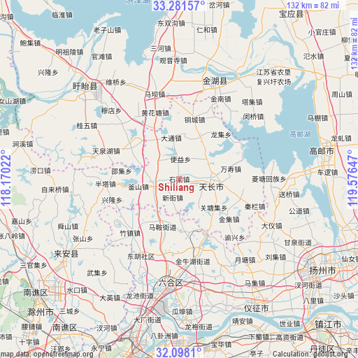
Shiliang GPS coordinates[2]
32° 41' 30.48" North, 118° 52' 24.024" East
| Map corner | latitude | longitude |
|---|---|---|
| Upper-left | 33.28157°, | 118.17022° |
| Center: | 32.6918°, | 118.87334° |
| Lower-right: | 32.0981°, | 119.57647° |
| Map W x H: | 131.6×131.6 km | = 81.8×81.8mi |
| max Lat: | 53.31946° ⇑35.2% North |
| Shiliang: | 32.6918° |
| min Lat: | ⇓64.8% South 18.22056° |
| min Long | Shiliang | max Long |
| 75.07348° | 118.87334° | 134.28917° |
| W 75.4%⇐ | ⇒24.6% E |
Elevation
Elevation of Shiliang is 25 m = 82 ft, and this is 459.8 m = 1509 ft below average elevation for this country.
| Max E: |
5622 m = 18445 ft | 80.8% |
| Avg. | 484.8 m = 1591 ft | |
| Shiliang | 25 m = 82 ft | |
Min E: |
-3 m = -10 ft | 19.2% |
See also: China elevation on elevation.city.
Geographical zone
Shiliang is located in North temperate zone (between Tropic of Cancer and the Arctic Circle). Distance of this Northern Tropic circle is 1029.1 km =639.5 mi to South.| Distance of | km | miles | from Shiliang |
|---|---|---|---|
| North Pole | 6372.1 | 3959.4 | to North |
| Arctic Circle | 3766.2 | 2340.2 | to North |
| Tropic Cancer | 1029.1 | 639.5 | to South |
| Equator | 3635 | 2258.7 | to South |


Nearby cities:
15 places around Shiliang: (largest is in red/bold)
• Chajian
9.9 km =6.2 mi,  260°
260°
• Datong
15.4 km =9.6 mi,  349°
349°
• Jinji
23.5 km =14.6 mi,  129°
129°
• Jiupu
22.8 km =14.2 mi,  306°
306°
• Maji
18.9 km =11.7 mi,  198°
198°
• Tianchang
12.7 km =7.9 mi,  93°
93°
• Tongcheng
23.6 km =14.7 mi,  13°
13°
• Wanshou
19.6 km =12.2 mi,  78°
78°
• Xinjie
7.2 km =4.5 mi, 201°
• Yangcun
14.7 km =9.1 mi,  41°
41°
• Yeshan
16 km =9.9 mi, 126°
• Yeshan
20.1 km =12.5 mi,  169°
169°
• Yongfeng
11.9 km =7.4 mi,  68°
68°
• Zhangpu
11.2 km =7 mi, 312°
• Zhengji
12.7 km =7.9 mi,  147°
147°
Sources, notices
• [Note1] Compared only with cities in China existing in our database
• [Src1] Map data: © OpenStreetMap contributors (CC-BY-SA)
• [Src2] Other city data from geonames.org with taken over terms of usage.
• [Src3] Geographical zone / Annual Mean Temperature by Robert A. Rohde @ Wikipedia
