Tanzhesi geodata
Tanzhesi (Beijing) is a seat of a fourth-order administrative division; located in China in Asia/Shanghai (GMT+8) time zone. In our database, there are 1268 cities with bigger population. Compared to other cities in China, 86% of cities are located further ↓South; 60.2% of cities are located further ←West and 53.5% of cities have lower elevation than Tanzhesi. Note1


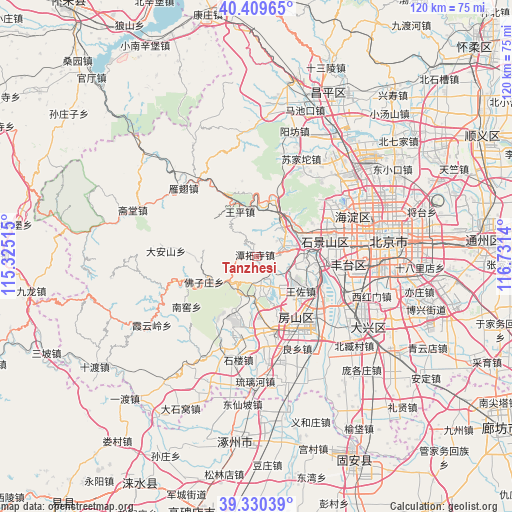
Tanzhesi GPS coordinates[2]
39° 52' 19.704" North, 116° 1' 41.772" East
| Map corner | latitude | longitude |
|---|---|---|
| Upper-left | 40.40965°, | 115.32515° |
| Center: | 39.87214°, | 116.02827° |
| Lower-right: | 39.33039°, | 116.7314° |
| Map W x H: | 120×120 km | = 74.6×74.6mi |
| max Lat: | 53.31946° ⇑14% North |
| Tanzhesi: | 39.87214° |
| min Lat: | ⇓86% South 18.22056° |
| min Long | Tanzhesi | max Long |
| 75.07348° | 116.02827° | 134.28917° |
| W 60.2%⇐ | ⇒39.8% E |
Elevation
Elevation of Tanzhesi is 193 m = 633 ft, and this is 291.8 m = 957 ft below average elevation for this country.
| Max E: |
5622 m = 18445 ft | 46.5% |
| Avg. | 484.8 m = 1591 ft | |
| Tanzhesi | 193 m = 633 ft | |
Min E: |
-3 m = -10 ft | 53.5% |
See also: China elevation on elevation.city.
Geographical zone
Tanzhesi is located in North temperate zone (between Tropic of Cancer and the Arctic Circle). Distance of this Northern Tropic circle is 1827.4 km =1135.5 mi to South.| Distance of | km | miles | from Tanzhesi |
|---|---|---|---|
| North Pole | 5573.7 | 3463.3 | to North |
| Arctic Circle | 2967.8 | 1844.1 | to North |
| Tropic Cancer | 1827.4 | 1135.5 | to South |
| Equator | 4433.4 | 2754.8 | to South |


Nearby cities:
15 places around Tanzhesi: (largest is in red/bold)
• Babaoshan
17.6 km =10.9 mi,  79°
79°
• Chengzi
10.2 km =6.3 mi,  30°
30°
• Dayu
9.3 km =5.8 mi,  38°
38°
• Gongchen
18.6 km =11.6 mi,  149°
149°
• Guangning
11.1 km =6.9 mi,  56°
56°
• Hebei
10.5 km =6.5 mi,  232°
232°
• Junzhuang
15.4 km =9.6 mi,  20°
20°
• Liangxiang
17.6 km =10.9 mi, 149°
• Lugu
16.6 km =10.3 mi, 80°
• Mentougou
9.2 km =5.7 mi, 36°
• Miaofengshan
11.5 km =7.1 mi,  8°
8°
• Qinglonghu
11 km =6.8 mi,  177°
177°
• Wangping
11.3 km =7 mi,  339°
339°
• Wangzuo
13.1 km =8.1 mi,  123°
123°
• Xiangyang
15.7 km =9.8 mi,  203°
203°
Sources, notices
• [Note1] Compared only with cities in China existing in our database
• [Src1] Map data: © OpenStreetMap contributors (CC-BY-SA)
• [Src2] Other city data from geonames.org with taken over terms of usage.
• [Src3] Geographical zone / Annual Mean Temperature by Robert A. Rohde @ Wikipedia
