Suonan geodata
Suonan (Gansu) is a seat of a third-order administrative division; located in China in Asia/Shanghai (GMT+8) time zone. In our database, there are 1268 cities with bigger population. Compared to other cities in China, 76.4% of cities are located further ↓South; 91% of cities are located further →East and 95.7% of cities have lower elevation than Suonan. Note1


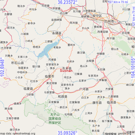
Suonan GPS coordinates[2]
35° 39' 59.508" North, 103° 23' 52.512" East
| Map corner | latitude | longitude |
|---|---|---|
| Upper-left | 36.23572°, | 102.6948° |
| Center: | 35.66653°, | 103.39792° |
| Lower-right: | 35.09326°, | 104.10105° |
| Map W x H: | 127×127 km | = 78.9×78.9mi |
| max Lat: | 53.31946° ⇑23.6% North |
| Suonan: | 35.66653° |
| min Lat: | ⇓76.4% South 18.22056° |
| min Long | Suonan | max Long |
| 75.07348° | 103.39792° | 134.28917° |
| W 9%⇐ | ⇒91% E |
Elevation
Elevation of Suonan is 2393 m = 7851 ft, and this is 1908.2 m = 6260 ft above average elevation for this country.
| Max E: |
5622 m = 18445 ft | 4.3% |
| Suonan | 2393 m 7851 ft | |
| Avg. | 484.8 m = 1591 ft | |
Min E: |
-3 m = -10 ft | 95.7% |
See also: China elevation on elevation.city.
Geographical zone
Suonan is located in North temperate zone (between Tropic of Cancer and the Arctic Circle). Distance of this Northern Tropic circle is 1359.8 km =844.9 mi to South.| Distance of | km | miles | from Suonan |
|---|---|---|---|
| North Pole | 6041.3 | 3753.9 | to North |
| Arctic Circle | 3435.4 | 2134.7 | to North |
| Tropic Cancer | 1359.8 | 844.9 | to South |
| Equator | 3965.7 | 2464.2 | to South |


Nearby cities:
15 places around Suonan: (largest is in red/bold)
• Biashizang
42 km =26.1 mi,  259°
259°
• Fucheng
42.9 km =26.7 mi,  139°
139°
• Guanghe Chengguanzhen
26.1 km =16.2 mi, 141°
• Guanjiachuan
43.4 km =27 mi,  284°
284°
• Guogan
36.7 km =22.8 mi,  267°
267°
• Hanji
41.3 km =25.7 mi,  242°
242°
• Hezheng Chengguanzhen
26.6 km =16.5 mi,  187°
187°
• Hulinjia
42.1 km =26.2 mi, 278°
• Juiji
42.2 km =26.2 mi, 267°
• Linxia Chengguanzhen
18.8 km =11.7 mi,  246°
246°
• Liujiaxia
30.6 km =19 mi,  346°
346°
• Xuhujia
40.3 km =25 mi, 269°
• Yingtan
39.9 km =24.8 mi, 254°
• Zhangzigou
41.8 km =26 mi, 247°
• Zhongzuiling
42.8 km =26.6 mi, 264°
Sources, notices
• [Note1] Compared only with cities in China existing in our database
• [Src1] Map data: © OpenStreetMap contributors (CC-BY-SA)
• [Src2] Other city data from geonames.org with taken over terms of usage.
• [Src3] Geographical zone / Annual Mean Temperature by Robert A. Rohde @ Wikipedia
