Shimenlou geodata
Shimenlou (Jiangxi) is a seat of a fourth-order administrative division; located in China in Asia/Shanghai (GMT+8) time zone. In our database, there are 1268 cities with bigger population. Compared to other cities in China, 65.7% of cities are located further ↑North; 53.4% of cities are located further ←West and 62.6% of cities have lower elevation than Shimenlou. Note1


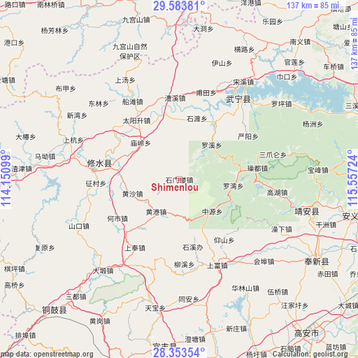
Shimenlou GPS coordinates[2]
28° 58' 13.8" North, 114° 51' 14.796" East
| Map corner | latitude | longitude |
|---|---|---|
| Upper-left | 29.58381°, | 114.15099° |
| Center: | 28.9705°, | 114.85411° |
| Lower-right: | 28.35354°, | 115.55724° |
| Map W x H: | 136.8×136.8 km | = 85×85mi |
| max Lat: | 53.31946° ⇑65.7% North |
| Shimenlou: | 28.9705° |
| min Lat: | ⇓34.3% South 18.22056° |
| min Long | Shimenlou | max Long |
| 75.07348° | 114.85411° | 134.28917° |
| W 53.4%⇐ | ⇒46.6% E |
Elevation
Elevation of Shimenlou is 291 m = 955 ft, and this is 193.8 m = 636 ft below average elevation for this country.
| Max E: |
5622 m = 18445 ft | 37.4% |
| Avg. | 484.8 m = 1591 ft | |
| Shimenlou | 291 m = 955 ft | |
Min E: |
-3 m = -10 ft | 62.6% |
See also: China elevation on elevation.city.
Geographical zone
Shimenlou is located in North temperate zone (between Tropic of Cancer and the Arctic Circle). Distance of this Northern Tropic circle is 615.3 km =382.3 mi to South.| Distance of | km | miles | from Shimenlou |
|---|---|---|---|
| North Pole | 6785.8 | 4216.5 | to North |
| Arctic Circle | 4180 | 2597.3 | to North |
| Tropic Cancer | 615.3 | 382.3 | to South |
| Equator | 3221.2 | 2001.6 | to South |


Nearby cities:
15 places around Shimenlou: (largest is in red/bold)
• Heshi
27.9 km =17.3 mi,  238°
238°
• Huanggang
15 km =9.3 mi,  215°
215°
• Huangsha
18.5 km =11.5 mi,  253°
253°
• Huang’ao
4.8 km =3 mi,  282°
282°
• Luowan
21 km =13 mi,  97°
97°
• Luoxi
18.2 km =11.3 mi,  43°
43°
• Miaoling
20.8 km =12.9 mi,  315°
315°
• Qingjiang
25.5 km =15.8 mi,  345°
345°
• Sandu
28 km =17.4 mi, 324°
• Shidu
27.8 km =17.3 mi,  15°
15°
• Shixi
26.2 km =16.3 mi,  168°
168°
• Yangshan
28.8 km =17.9 mi,  143°
143°
• Yining
29.2 km =18.1 mi, 284°
• Zaoxi
26.5 km =16.5 mi,  156°
156°
• Zhongyuan
17.5 km =10.9 mi,  133°
133°
Sources, notices
• [Note1] Compared only with cities in China existing in our database
• [Src1] Map data: © OpenStreetMap contributors (CC-BY-SA)
• [Src2] Other city data from geonames.org with taken over terms of usage.
• [Src3] Geographical zone / Annual Mean Temperature by Robert A. Rohde @ Wikipedia
