Shanhe geodata
Shanhe (Ningxia Hui Autonomous Region) is a seat of a fourth-order administrative division; located in China in Asia/Shanghai (GMT+8) time zone. In our database, there are 1268 cities with bigger population. Compared to other cities in China, 76% of cities are located further ↓South; 86.3% of cities are located further →East and 95.3% of cities have lower elevation than Shanhe. Note1


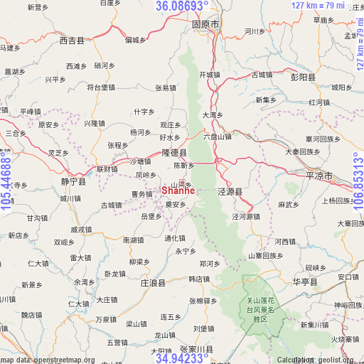
Shanhe GPS coordinates[2]
35° 31' 0.012" North, 106° 9' 0" East
| Map corner | latitude | longitude |
|---|---|---|
| Upper-left | 36.08693°, | 105.44688° |
| Center: | 35.51667°, | 106.15° |
| Lower-right: | 34.94233°, | 106.85313° |
| Map W x H: | 127.3×127.3 km | = 79.1×79.1mi |
| max Lat: | 53.31946° ⇑24% North |
| Shanhe: | 35.51667° |
| min Lat: | ⇓76% South 18.22056° |
| min Long | Shanhe | max Long |
| 75.07348° | 106.15° | 134.28917° |
| W 13.7%⇐ | ⇒86.3% E |
Elevation
Elevation of Shanhe is 2228 m = 7310 ft, and this is 1743.2 m = 5719 ft above average elevation for this country.
| Max E: |
5622 m = 18445 ft | 4.7% |
| Shanhe | 2228 m 7310 ft | |
| Avg. | 484.8 m = 1591 ft | |
Min E: |
-3 m = -10 ft | 95.3% |
See also: China elevation on elevation.city.
Geographical zone
Shanhe is located in North temperate zone (between Tropic of Cancer and the Arctic Circle). Distance of this Northern Tropic circle is 1343.2 km =834.6 mi to South.| Distance of | km | miles | from Shanhe |
|---|---|---|---|
| North Pole | 6058 | 3764.3 | to North |
| Arctic Circle | 3452.1 | 2145 | to North |
| Tropic Cancer | 1343.2 | 834.6 | to South |
| Equator | 3949.1 | 2453.9 | to South |


Nearby cities:
15 places around Shanhe: (largest is in red/bold)
• Chenjin
5.6 km =3.5 mi,  0°
0°
• Gongyi
43.3 km =26.9 mi,  296°
296°
• Gucheng
47 km =29.2 mi,  36°
36°
• Haoshui
15.5 km =9.6 mi,  343°
343°
• Jingning Chengguanzhen
38.6 km =24 mi,  270°
270°
• Liancai
26.7 km =16.6 mi,  280°
280°
• Longde Chengguanzhen
11.1 km =6.9 mi, 344°
• Malianchuan
38.4 km =23.9 mi,  327°
327°
• Nanhu
26.3 km =16.3 mi,  220°
220°
• Shatang
16.5 km =10.3 mi, 297°
• Shenlin
21.6 km =13.4 mi,  289°
289°
• Weirong
38.9 km =24.2 mi,  244°
244°
• Xiangshui
17 km =10.6 mi,  105°
105°
• Xinglong
37.1 km =23.1 mi, 304°
• Xingsheng
18.2 km =11.3 mi, 114°
Sources, notices
• [Note1] Compared only with cities in China existing in our database
• [Src1] Map data: © OpenStreetMap contributors (CC-BY-SA)
• [Src2] Other city data from geonames.org with taken over terms of usage.
• [Src3] Geographical zone / Annual Mean Temperature by Robert A. Rohde @ Wikipedia
