Xingsheng geodata
Xingsheng (Ningxia Hui Autonomous Region) is a seat of a fourth-order administrative division; located in China in Asia/Shanghai (GMT+8) time zone. In our database, there are 1268 cities with bigger population. Compared to other cities in China, 75.9% of cities are located further ↓South; 85.7% of cities are located further →East and 94.1% of cities have lower elevation than Xingsheng. Note1


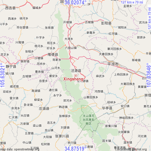
Xingsheng GPS coordinates[2]
35° 27' 0" North, 106° 19' 59.988" East
| Map corner | latitude | longitude |
|---|---|---|
| Upper-left | 36.02074°, | 105.63021° |
| Center: | 35.45°, | 106.33333° |
| Lower-right: | 34.87519°, | 107.03646° |
| Map W x H: | 127.4×127.4 km | = 79.2×79.2mi |
| max Lat: | 53.31946° ⇑24.1% North |
| Xingsheng: | 35.45° |
| min Lat: | ⇓75.9% South 18.22056° |
| min Long | Xingsheng | max Long |
| 75.07348° | 106.33333° | 134.28917° |
| W 14.3%⇐ | ⇒85.7% E |
Elevation
Elevation of Xingsheng is 1888 m = 6194 ft, and this is 1403.2 m = 4604 ft above average elevation for this country.
| Max E: |
5622 m = 18445 ft | 5.9% |
| Xingsheng | 1888 m 6194 ft | |
| Avg. | 484.8 m = 1591 ft | |
Min E: |
-3 m = -10 ft | 94.1% |
See also: China elevation on elevation.city.
Geographical zone
Xingsheng is located in North temperate zone (between Tropic of Cancer and the Arctic Circle). Distance of this Northern Tropic circle is 1335.8 km =830 mi to South.| Distance of | km | miles | from Xingsheng |
|---|---|---|---|
| North Pole | 6065.4 | 3768.9 | to North |
| Arctic Circle | 3459.5 | 2149.6 | to North |
| Tropic Cancer | 1335.8 | 830 | to South |
| Equator | 3941.7 | 2449.3 | to South |


Nearby cities:
15 places around Xingsheng: (largest is in red/bold)
• Ankou
48.8 km =30.3 mi,  121°
121°
• Chenjin
21.1 km =13.1 mi,  308°
308°
• Donghua
39 km =24.2 mi,  131°
131°
• Gucheng
46.6 km =29 mi,  13°
13°
• Haoshui
30.7 km =19.1 mi,  316°
316°
• Honghe
48.4 km =30.1 mi,  43°
43°
• Liancai
44.6 km =27.7 mi,  285°
285°
• Longde Chengguanzhen
26.7 km =16.6 mi, 312°
• Nanhu
36 km =22.4 mi,  249°
249°
• Pingliang
33.4 km =20.8 mi,  72°
72°
• Shanhe
18.2 km =11.3 mi, 294°
• Shatang
34.7 km =21.6 mi,  295°
295°
• Shenlin
39.7 km =24.7 mi, 291°
• Xiangshui
3 km =1.9 mi,  356°
356°
• Zhudian
51.1 km =31.8 mi,  223°
223°
Sources, notices
• [Note1] Compared only with cities in China existing in our database
• [Src1] Map data: © OpenStreetMap contributors (CC-BY-SA)
• [Src2] Other city data from geonames.org with taken over terms of usage.
• [Src3] Geographical zone / Annual Mean Temperature by Robert A. Rohde @ Wikipedia
