Longde Chengguanzhen geodata
Longde Chengguanzhen (Ningxia Hui Autonomous Region) is a seat of a third-order administrative division; located in China in Asia/Shanghai (GMT+8) time zone. In our database, there are 1268 cities with bigger population. Compared to other cities in China, 76.3% of cities are located further ↓South; 86.5% of cities are located further →East and 94.9% of cities have lower elevation than Longde Chengguanzhen. Note1


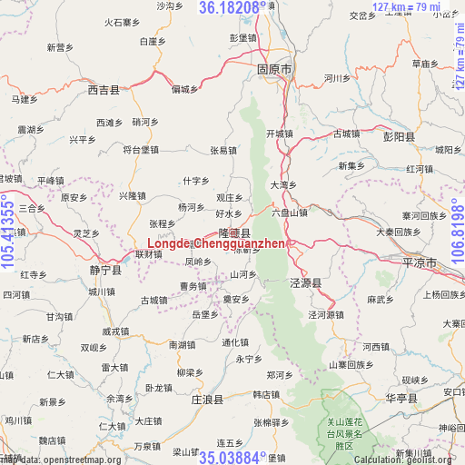
Longde Chengguanzhen GPS coordinates[2]
35° 36' 45" North, 106° 7' 0.012" East
| Map corner | latitude | longitude |
|---|---|---|
| Upper-left | 36.18208°, | 105.41355° |
| Center: | 35.6125°, | 106.11667° |
| Lower-right: | 35.03884°, | 106.8198° |
| Map W x H: | 127.1×127.1 km | = 79×79mi |
| max Lat: | 53.31946° ⇑23.7% North |
| Longde Chengguanzhen: | 35.6125° |
| min Lat: | ⇓76.3% South 18.22056° |
| min Long | Longde Chenggua | max Long |
| 75.07348° | 106.11667° | 134.28917° |
| W 13.5%⇐ | ⇒86.5% E |
Elevation
Elevation of Longde Chengguanzhen is 2091 m = 6860 ft, and this is 1606.2 m = 5270 ft above average elevation for this country.
| Max E: |
5622 m = 18445 ft | 5.1% |
| Longde Chengguanzhen | 2091 m 6860 ft | |
| Avg. | 484.8 m = 1591 ft | |
Min E: |
-3 m = -10 ft | 94.9% |
See also: China elevation on elevation.city.
Geographical zone
Longde Chengguanzhen is located in North temperate zone (between Tropic of Cancer and the Arctic Circle). Distance of this Northern Tropic circle is 1353.8 km =841.2 mi to South.| Distance of | km | miles | from Longde Chengguanzhen |
|---|---|---|---|
| North Pole | 6047.3 | 3757.6 | to North |
| Arctic Circle | 3441.4 | 2138.4 | to North |
| Tropic Cancer | 1353.8 | 841.2 | to South |
| Equator | 3959.7 | 2460.4 | to South |


Nearby cities:
15 places around Longde Chengguanzhen: (largest is in red/bold)
• Bange
38.9 km =24.2 mi,  321°
321°
• Chenjin
5.9 km =3.7 mi,  149°
149°
• Gongyi
36.7 km =22.8 mi,  283°
283°
• Haoshui
4.4 km =2.7 mi,  340°
340°
• Jingning Chengguanzhen
37 km =23 mi,  253°
253°
• Liancai
24 km =14.9 mi,  255°
255°
• Malianchuan
28 km =17.4 mi, 321°
• Nanhu
33.7 km =20.9 mi,  204°
204°
• Shanhe
11.1 km =6.9 mi,  164°
164°
• Shatang
12.1 km =7.5 mi, 254°
• Shenlin
17.7 km =11 mi, 258°
• Wangmin
40.3 km =25 mi,  301°
301°
• Xiangshui
24.6 km =15.3 mi,  127°
127°
• Xinglong
29.5 km =18.3 mi,  290°
290°
• Xingsheng
26.7 km =16.6 mi, 132°
Sources, notices
• [Note1] Compared only with cities in China existing in our database
• [Src1] Map data: © OpenStreetMap contributors (CC-BY-SA)
• [Src2] Other city data from geonames.org with taken over terms of usage.
• [Src3] Geographical zone / Annual Mean Temperature by Robert A. Rohde @ Wikipedia
