Shagang geodata
Shagang (Hubei) is a seat of a fourth-order administrative division; located in China in Asia/Shanghai (GMT+8) time zone. In our database, there are 1268 cities with bigger population. Compared to other cities in China, 53.3% of cities are located further ↑North; 59.4% of cities are located further →East and 78.8% of cities have higher elevation than Shagang. Note1


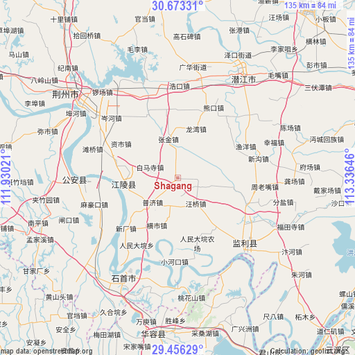
Shagang GPS coordinates[2]
30° 4' 0.012" North, 112° 37' 59.988" East
| Map corner | latitude | longitude |
|---|---|---|
| Upper-left | 30.67331°, | 111.93021° |
| Center: | 30.06667°, | 112.63333° |
| Lower-right: | 29.45629°, | 113.33646° |
| Map W x H: | 135.3×135.3 km | = 84.1×84.1mi |
| max Lat: | 53.31946° ⇑53.3% North |
| Shagang: | 30.06667° |
| min Lat: | ⇓46.7% South 18.22056° |
| min Long | Shagang | max Long |
| 75.07348° | 112.63333° | 134.28917° |
| W 40.6%⇐ | ⇒59.4% E |
Elevation
Elevation of Shagang is 29 m = 95 ft, and this is 455.8 m = 1495 ft below average elevation for this country.
| Max E: |
5622 m = 18445 ft | 78.8% |
| Avg. | 484.8 m = 1591 ft | |
| Shagang | 29 m = 95 ft | |
Min E: |
-3 m = -10 ft | 21.2% |
See also: China elevation on elevation.city.
Geographical zone
Shagang is located in North temperate zone (between Tropic of Cancer and the Arctic Circle). Distance of this Northern Tropic circle is 737.2 km =458.1 mi to South.| Distance of | km | miles | from Shagang |
|---|---|---|---|
| North Pole | 6664 | 4140.8 | to North |
| Arctic Circle | 4058.1 | 2521.6 | to North |
| Tropic Cancer | 737.2 | 458.1 | to South |
| Equator | 3343.1 | 2077.3 | to South |


Nearby cities:
15 places around Shagang: (largest is in red/bold)
• Baimasi
11.3 km =7 mi,  290°
290°
• Chengji
14.4 km =8.9 mi,  179°
179°
• Haoxue
16.1 km =10 mi,  262°
262°
• Hengshi
19.9 km =12.4 mi,  203°
203°
• Huangxiekou
21.4 km =13.3 mi,  100°
100°
• Laoxin
25.1 km =15.6 mi,  56°
56°
• Puji
13.4 km =8.3 mi,  225°
225°
• Qinshi
11.3 km =7 mi, 196°
• Wangqiao
12.1 km =7.5 mi,  145°
145°
• Xinchang
27.7 km =17.2 mi, 225°
• Xionghe
18.4 km =11.4 mi,  276°
276°
• Xiongkou
29.9 km =18.6 mi,  27°
27°
• Yuyang
28.5 km =17.7 mi,  65°
65°
• Zhangjin
14.9 km =9.3 mi,  346°
346°
• Zishi
25.1 km =15.6 mi,  300°
300°
Sources, notices
• [Note1] Compared only with cities in China existing in our database
• [Src1] Map data: © OpenStreetMap contributors (CC-BY-SA)
• [Src2] Other city data from geonames.org with taken over terms of usage.
• [Src3] Geographical zone / Annual Mean Temperature by Robert A. Rohde @ Wikipedia
