Sanxi geodata
Sanxi (Jiangxi) is a seat of a fourth-order administrative division; located in China in Asia/Shanghai (GMT+8) time zone. In our database, there are 1268 cities with bigger population. Compared to other cities in China, 78% of cities are located further ↑North; 62.4% of cities are located further ←West and 54.5% of cities have lower elevation than Sanxi. Note1


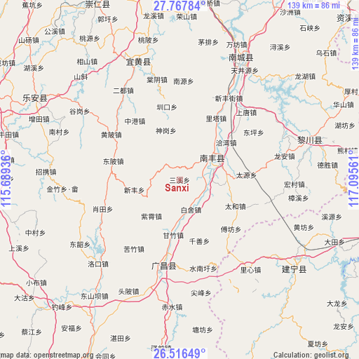
Sanxi GPS coordinates[2]
27° 8' 38.112" North, 116° 23' 32.928" East
| Map corner | latitude | longitude |
|---|---|---|
| Upper-left | 27.76784°, | 115.68936° |
| Center: | 27.14392°, | 116.39248° |
| Lower-right: | 26.51649°, | 117.09561° |
| Map W x H: | 139.1×139.1 km | = 86.4×86.4mi |
| max Lat: | 53.31946° ⇑78% North |
| Sanxi: | 27.14392° |
| min Lat: | ⇓22% South 18.22056° |
| min Long | Sanxi | max Long |
| 75.07348° | 116.39248° | 134.28917° |
| W 62.4%⇐ | ⇒37.6% E |
Elevation
Elevation of Sanxi is 201 m = 659 ft, and this is 283.8 m = 931 ft below average elevation for this country.
| Max E: |
5622 m = 18445 ft | 45.5% |
| Avg. | 484.8 m = 1591 ft | |
| Sanxi | 201 m = 659 ft | |
Min E: |
-3 m = -10 ft | 54.5% |
See also: China elevation on elevation.city.
Geographical zone
Sanxi is located in North temperate zone (between Tropic of Cancer and the Arctic Circle). Distance of this Northern Tropic circle is 412.2 km =256.1 mi to South.| Distance of | km | miles | from Sanxi |
|---|---|---|---|
| North Pole | 6988.9 | 4342.7 | to North |
| Arctic Circle | 4383.1 | 2723.5 | to North |
| Tropic Cancer | 412.2 | 256.1 | to South |
| Equator | 3018.1 | 1875.4 | to South |


Nearby cities:
15 places around Sanxi: (largest is in red/bold)
• Baishe
12.3 km =7.6 mi,  159°
159°
• Dongbei
26.9 km =16.7 mi,  285°
285°
• Fufang
27.6 km =17.1 mi,  133°
133°
• Laixi
19.7 km =12.2 mi,  68°
68°
• Lita
27.8 km =17.3 mi,  30°
30°
• Qianshan
24.9 km =15.5 mi, 162°
• Qiawan
23.1 km =14.4 mi,  51°
51°
• Qincheng
15.6 km =9.7 mi,  60°
60°
• Sangtian
17.4 km =10.8 mi,  96°
96°
• Shishan
12.8 km =8 mi, 53°
• Taihe
23.9 km =14.9 mi,  115°
115°
• Xiaotian
31.8 km =19.8 mi,  249°
249°
• Xinfeng
18.2 km =11.3 mi,  257°
257°
• Zhenkou
28.8 km =17.9 mi,  350°
350°
• Zixiao
17.8 km =11.1 mi,  217°
217°
Sources, notices
• [Note1] Compared only with cities in China existing in our database
• [Src1] Map data: © OpenStreetMap contributors (CC-BY-SA)
• [Src2] Other city data from geonames.org with taken over terms of usage.
• [Src3] Geographical zone / Annual Mean Temperature by Robert A. Rohde @ Wikipedia
