Renchaoxi geodata
Renchaoxi (Hunan) is a seat of a fourth-order administrative division; located in China in Asia/Shanghai (GMT+8) time zone. In our database, there are 1268 cities with bigger population. Compared to other cities in China, 58.5% of cities are located further ↑North; 68.7% of cities are located further →East and 59.7% of cities have lower elevation than Renchaoxi. Note1


Renchaoxi GPS coordinates[2]
29° 36' 32.328" North, 110° 35' 8.412" East
| Map corner | latitude | longitude |
|---|---|---|
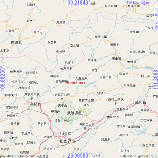
| Upper-left | 30.21843°, | 109.88255° |
| Center: | 29.60898°, | 110.58567° |
| Lower-right: | 28.99583°, | 111.2888° |
| Map W x H: | 135.9×135.9 km | = 84.4×84.4mi |
| max Lat: | 53.31946° ⇑58.5% North |
| Renchaoxi: | 29.60898° |
| min Lat: | ⇓41.5% South 18.22056° |
| min Long | Renchaoxi | max Long |
| 75.07348° | 110.58567° | 134.28917° |
| W 31.3%⇐ | ⇒68.7% E |
Elevation
Elevation of Renchaoxi is 256 m = 840 ft, and this is 228.8 m = 751 ft below average elevation for this country.
| Max E: |
5622 m = 18445 ft | 40.3% |
| Avg. | 484.8 m = 1591 ft | |
| Renchaoxi | 256 m = 840 ft | |
Min E: |
-3 m = -10 ft | 59.7% |
See also: China elevation on elevation.city.
Geographical zone
Renchaoxi is located in North temperate zone (between Tropic of Cancer and the Arctic Circle). Distance of this Northern Tropic circle is 686.3 km =426.4 mi to South.| Distance of | km | miles | from Renchaoxi |
|---|---|---|---|
| North Pole | 6714.9 | 4172.4 | to North |
| Arctic Circle | 4109 | 2553.2 | to North |
| Tropic Cancer | 686.3 | 426.4 | to South |
| Equator | 3292.2 | 2045.7 | to South |


Nearby cities:
15 places around Renchaoxi: (largest is in red/bold)
• Baishi
10.5 km =6.5 mi,  359°
359°
• Guandiping
14.6 km =9.1 mi,  262°
262°
• Huochiyu
19.6 km =12.2 mi,  214°
214°
• Jiangya
20.8 km =12.9 mi,  124°
124°
• Linxihe
20.9 km =13 mi,  277°
277°
• Luojiaping
19.6 km =12.2 mi,  33°
33°
• Sanguansi
20.8 km =12.9 mi,  161°
161°
• Suoziqiu
22.4 km =13.9 mi,  250°
250°
• Xianchiyu
19.6 km =12.2 mi, 214°
• Xilian
15.9 km =9.9 mi,  60°
60°
• Zhaojiagang
15.3 km =9.5 mi,  144°
144°
• Zhenjiatai
14.2 km =8.8 mi,  311°
311°
• Zhujiatai
16.6 km =10.3 mi,  331°
331°
• Zhuyeping
15.8 km =9.8 mi,  195°
195°
• Zoumaping
20.7 km =12.9 mi,  222°
222°
Sources, notices
• [Note1] Compared only with cities in China existing in our database
• [Src1] Map data: © OpenStreetMap contributors (CC-BY-SA)
• [Src2] Other city data from geonames.org with taken over terms of usage.
• [Src3] Geographical zone / Annual Mean Temperature by Robert A. Rohde @ Wikipedia
