Jiangya geodata
Jiangya (Hunan) is a seat of a fourth-order administrative division; located in China in Asia/Shanghai (GMT+8) time zone. In our database, there are 1268 cities with bigger population. Compared to other cities in China, 59.7% of cities are located further ↑North; 68% of cities are located further →East and 51.5% of cities have higher elevation than Jiangya. Note1


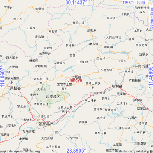
Jiangya GPS coordinates[2]
29° 30' 15.408" North, 110° 45' 49.752" East
| Map corner | latitude | longitude |
|---|---|---|
| Upper-left | 30.11437°, | 110.0607° |
| Center: | 29.50428°, | 110.76382° |
| Lower-right: | 28.8905°, | 111.46695° |
| Map W x H: | 136.1×136.1 km | = 84.6×84.6mi |
| max Lat: | 53.31946° ⇑59.7% North |
| Jiangya: | 29.50428° |
| min Lat: | ⇓40.3% South 18.22056° |
| min Long | Jiangya | max Long |
| 75.07348° | 110.76382° | 134.28917° |
| W 32%⇐ | ⇒68% E |
Elevation
Elevation of Jiangya is 153 m = 502 ft, and this is 331.8 m = 1089 ft below average elevation for this country.
| Max E: |
5622 m = 18445 ft | 51.5% |
| Avg. | 484.8 m = 1591 ft | |
| Jiangya | 153 m = 502 ft | |
Min E: |
-3 m = -10 ft | 48.5% |
See also: China elevation on elevation.city.
Geographical zone
Jiangya is located in North temperate zone (between Tropic of Cancer and the Arctic Circle). Distance of this Northern Tropic circle is 674.6 km =419.2 mi to South.| Distance of | km | miles | from Jiangya |
|---|---|---|---|
| North Pole | 6726.5 | 4179.7 | to North |
| Arctic Circle | 4120.6 | 2560.4 | to North |
| Tropic Cancer | 674.6 | 419.2 | to South |
| Equator | 3280.6 | 2038.5 | to South |


Nearby cities:
15 places around Jiangya: (largest is in red/bold)
• Ganyan
25.1 km =15.6 mi,  176°
176°
• Gaofeng
16.6 km =10.3 mi,  116°
116°
• Nanshanping
24.3 km =15.1 mi,  148°
148°
• Renchaoxi
20.8 km =12.9 mi,  304°
304°
• Sanguansi
13.5 km =8.4 mi,  232°
232°
• Sanhekou
14.8 km =9.2 mi,  23°
23°
• Shanmuqiao
16.7 km =10.4 mi,  76°
76°
• Tongjinpu
20 km =12.4 mi, 79°
• Xiangshi
7.3 km =4.5 mi, 78°
• Xilian
19.7 km =12.2 mi,  350°
350°
• Yanbodu
24.5 km =15.2 mi,  126°
126°
• Yichongqiao
21.4 km =13.3 mi, 153°
• Zhaojiagang
8.5 km =5.3 mi,  263°
263°
• Zhuangta
19.1 km =11.9 mi,  43°
43°
• Zhuyeping
21.8 km =13.5 mi, 260°
Sources, notices
• [Note1] Compared only with cities in China existing in our database
• [Src1] Map data: © OpenStreetMap contributors (CC-BY-SA)
• [Src2] Other city data from geonames.org with taken over terms of usage.
• [Src3] Geographical zone / Annual Mean Temperature by Robert A. Rohde @ Wikipedia
