Sanguansi geodata
Sanguansi (Hunan) is a seat of a fourth-order administrative division; located in China in Asia/Shanghai (GMT+8) time zone. In our database, there are 1268 cities with bigger population. Compared to other cities in China, 60.5% of cities are located further ↑North; 68.5% of cities are located further →East and 56.8% of cities have lower elevation than Sanguansi. Note1


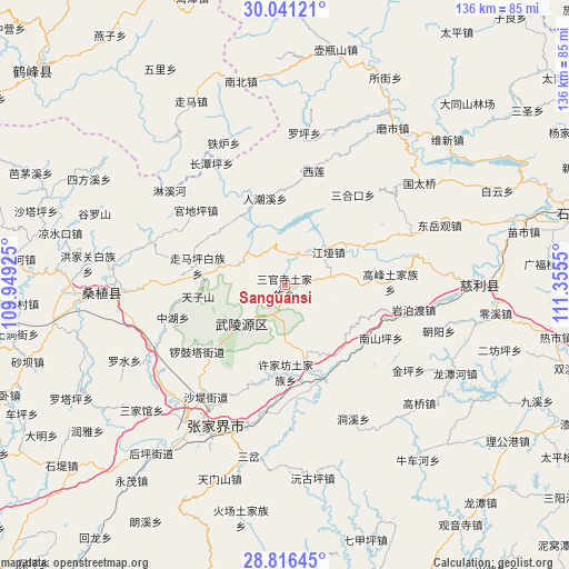
Sanguansi GPS coordinates[2]
29° 25' 50.448" North, 110° 39' 8.532" East
| Map corner | latitude | longitude |
|---|---|---|
| Upper-left | 30.04121°, | 109.94925° |
| Center: | 29.43068°, | 110.65237° |
| Lower-right: | 28.81645°, | 111.3555° |
| Map W x H: | 136.2×136.2 km | = 84.6×84.6mi |
| max Lat: | 53.31946° ⇑60.5% North |
| Sanguansi: | 29.43068° |
| min Lat: | ⇓39.5% South 18.22056° |
| min Long | Sanguansi | max Long |
| 75.07348° | 110.65237° | 134.28917° |
| W 31.5%⇐ | ⇒68.5% E |
Elevation
Elevation of Sanguansi is 224 m = 735 ft, and this is 260.8 m = 856 ft below average elevation for this country.
| Max E: |
5622 m = 18445 ft | 43.2% |
| Avg. | 484.8 m = 1591 ft | |
| Sanguansi | 224 m = 735 ft | |
Min E: |
-3 m = -10 ft | 56.8% |
See also: China elevation on elevation.city.
Geographical zone
Sanguansi is located in North temperate zone (between Tropic of Cancer and the Arctic Circle). Distance of this Northern Tropic circle is 666.5 km =414.1 mi to South.| Distance of | km | miles | from Sanguansi |
|---|---|---|---|
| North Pole | 6734.7 | 4184.7 | to North |
| Arctic Circle | 4128.8 | 2565.5 | to North |
| Tropic Cancer | 666.5 | 414.1 | to South |
| Equator | 3272.4 | 2033.4 | to South |


Nearby cities:
15 places around Sanguansi: (largest is in red/bold)
• Ganyan
20.9 km =13 mi,  143°
143°
• Huochiyu
17.8 km =11.1 mi,  281°
281°
• Jiangya
13.5 km =8.4 mi,  52°
52°
• Liulang
20.6 km =12.8 mi,  222°
222°
• Renchaoxi
20.8 km =12.9 mi,  341°
341°
• Tianzishan
21 km =13 mi,  263°
263°
• Wulingyuan
13.9 km =8.6 mi,  229°
229°
• Xianchiyu
17.9 km =11.1 mi, 281°
• Xiangshi
20.3 km =12.6 mi,  61°
61°
• Xujiafang
20.8 km =12.9 mi,  179°
179°
• Yanghe
19.1 km =11.9 mi,  164°
164°
• Yujiazui
12.2 km =7.6 mi, 225°
• Zhaojiagang
7.7 km =4.8 mi,  18°
18°
• Zhuyeping
11.7 km =7.3 mi,  293°
293°
• Zoumaping
20.9 km =13 mi, 282°
Sources, notices
• [Note1] Compared only with cities in China existing in our database
• [Src1] Map data: © OpenStreetMap contributors (CC-BY-SA)
• [Src2] Other city data from geonames.org with taken over terms of usage.
• [Src3] Geographical zone / Annual Mean Temperature by Robert A. Rohde @ Wikipedia
