Ranghe geodata
Ranghe (Henan) is a seat of a fourth-order administrative division; located in China in Asia/Shanghai (GMT+8) time zone. In our database, there are 1268 cities with bigger population. Compared to other cities in China, 68.7% of cities are located further ↓South; 58.4% of cities are located further →East and 52.9% of cities have higher elevation than Ranghe. Note1


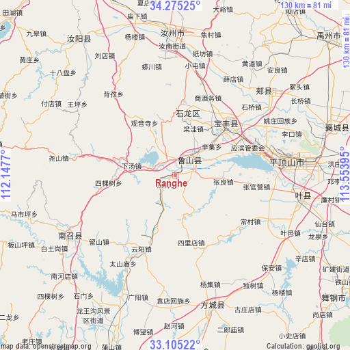
Ranghe GPS coordinates[2]
33° 41' 32.028" North, 112° 51' 2.952" East
| Map corner | latitude | longitude |
|---|---|---|
| Upper-left | 34.27525°, | 112.1477° |
| Center: | 33.69223°, | 112.85082° |
| Lower-right: | 33.10522°, | 113.55395° |
| Map W x H: | 130.1×130.1 km | = 80.8×80.8mi |
| max Lat: | 53.31946° ⇑31.3% North |
| Ranghe: | 33.69223° |
| min Lat: | ⇓68.7% South 18.22056° |
| min Long | Ranghe | max Long |
| 75.07348° | 112.85082° | 134.28917° |
| W 41.6%⇐ | ⇒58.4% E |
Elevation
Elevation of Ranghe is 144 m = 472 ft, and this is 340.8 m = 1118 ft below average elevation for this country.
| Max E: |
5622 m = 18445 ft | 52.9% |
| Avg. | 484.8 m = 1591 ft | |
| Ranghe | 144 m = 472 ft | |
Min E: |
-3 m = -10 ft | 47.1% |
See also: China elevation on elevation.city.
Geographical zone
Ranghe is located in North temperate zone (between Tropic of Cancer and the Arctic Circle). Distance of this Northern Tropic circle is 1140.3 km =708.5 mi to South.| Distance of | km | miles | from Ranghe |
|---|---|---|---|
| North Pole | 6260.8 | 3890.3 | to North |
| Arctic Circle | 3654.9 | 2271 | to North |
| Tropic Cancer | 1140.3 | 708.5 | to South |
| Equator | 3746.2 | 2327.8 | to South |


Nearby cities:
15 places around Ranghe: (largest is in red/bold)
• Cangtou
21.2 km =13.2 mi,  344°
344°
• Dongzhou
11 km =6.8 mi, 338°
• Guanyinsi
22.5 km =14 mi,  329°
329°
• Jizhong
17.1 km =10.6 mi,  248°
248°
• Liangwa
18.4 km =11.4 mi,  21°
21°
• Luyang
7 km =4.3 mi,  46°
46°
• Malou
12.6 km =7.8 mi,  96°
96°
• Nanguzhuang
23.2 km =14.4 mi,  5°
5°
• Xiatang
16.1 km =10 mi,  280°
280°
• Xinji
17.5 km =10.9 mi, 52°
• Xiongbei
4.9 km =3 mi,  227°
227°
• Yangzhuang
23.3 km =14.5 mi, 46°
• Zhangbaqiao
22.2 km =13.8 mi,  26°
26°
• Zhangdian
9.4 km =5.8 mi, 18°
• Zhangliang
17.7 km =11 mi, 98°
Sources, notices
• [Note1] Compared only with cities in China existing in our database
• [Src1] Map data: © OpenStreetMap contributors (CC-BY-SA)
• [Src2] Other city data from geonames.org with taken over terms of usage.
• [Src3] Geographical zone / Annual Mean Temperature by Robert A. Rohde @ Wikipedia
