Liangwa geodata
Liangwa (Henan) is a seat of a fourth-order administrative division; located in China in Asia/Shanghai (GMT+8) time zone. In our database, there are 1268 cities with bigger population. Compared to other cities in China, 69.4% of cities are located further ↓South; 58% of cities are located further →East and 54.2% of cities have lower elevation than Liangwa. Note1


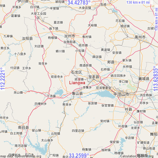
Liangwa GPS coordinates[2]
33° 50' 45.096" North, 112° 55' 30.792" East
| Map corner | latitude | longitude |
|---|---|---|
| Upper-left | 34.42783°, | 112.2221° |
| Center: | 33.84586°, | 112.92522° |
| Lower-right: | 33.2599°, | 113.62835° |
| Map W x H: | 129.9×129.9 km | = 80.7×80.7mi |
| max Lat: | 53.31946° ⇑30.6% North |
| Liangwa: | 33.84586° |
| min Lat: | ⇓69.4% South 18.22056° |
| min Long | Liangwa | max Long |
| 75.07348° | 112.92522° | 134.28917° |
| W 42%⇐ | ⇒58% E |
Elevation
Elevation of Liangwa is 199 m = 653 ft, and this is 285.8 m = 938 ft below average elevation for this country.
| Max E: |
5622 m = 18445 ft | 45.8% |
| Avg. | 484.8 m = 1591 ft | |
| Liangwa | 199 m = 653 ft | |
Min E: |
-3 m = -10 ft | 54.2% |
See also: China elevation on elevation.city.
Geographical zone
Liangwa is located in North temperate zone (between Tropic of Cancer and the Arctic Circle). Distance of this Northern Tropic circle is 1157.4 km =719.2 mi to South.| Distance of | km | miles | from Liangwa |
|---|---|---|---|
| North Pole | 6243.8 | 3879.7 | to North |
| Arctic Circle | 3637.9 | 2260.5 | to North |
| Tropic Cancer | 1157.4 | 719.2 | to South |
| Equator | 3763.3 | 2338.4 | to South |


Nearby cities:
15 places around Liangwa: (largest is in red/bold)
• Baofeng Chengguanzhen
13.2 km =8.2 mi,  78°
78°
• Cangtou
12.8 km =8 mi,  285°
285°
• Daying
10.9 km =6.8 mi,  339°
339°
• Dongzhou
12.9 km =8 mi,  237°
237°
• Luyang
12.4 km =7.7 mi,  188°
188°
• Nanguzhuang
7.5 km =4.7 mi,  323°
323°
• Qianying
14.9 km =9.3 mi,  354°
354°
• Ranghe
18.4 km =11.4 mi,  201°
201°
• Shangjiuwu
12.4 km =7.7 mi,  22°
22°
• Xiaoqi
14.7 km =9.1 mi,  57°
57°
• Xinji
9.4 km =5.8 mi,  132°
132°
• Yangzhuang
10.2 km =6.3 mi,  96°
96°
• Zhangbaqiao
4.2 km =2.6 mi,  49°
49°
• Zhangdian
9 km =5.6 mi,  205°
205°
• Zhouzhuang
17.7 km =11 mi, 84°
Sources, notices
• [Note1] Compared only with cities in China existing in our database
• [Src1] Map data: © OpenStreetMap contributors (CC-BY-SA)
• [Src2] Other city data from geonames.org with taken over terms of usage.
• [Src3] Geographical zone / Annual Mean Temperature by Robert A. Rohde @ Wikipedia
