Nanguzhuang geodata
Nanguzhuang (Henan) is a seat of a fourth-order administrative division; located in China in Asia/Shanghai (GMT+8) time zone. In our database, there are 1268 cities with bigger population. Compared to other cities in China, 69.6% of cities are located further ↓South; 58.3% of cities are located further →East and 57.8% of cities have lower elevation than Nanguzhuang. Note1


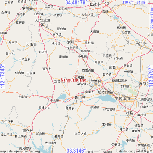
Nanguzhuang GPS coordinates[2]
33° 54' 0.684" North, 112° 52' 35.652" East
| Map corner | latitude | longitude |
|---|---|---|
| Upper-left | 34.48179°, | 112.17345° |
| Center: | 33.90019°, | 112.87657° |
| Lower-right: | 33.3146°, | 113.5797° |
| Map W x H: | 129.8×129.8 km | = 80.7×80.7mi |
| max Lat: | 53.31946° ⇑30.4% North |
| Nanguzhuang: | 33.90019° |
| min Lat: | ⇓69.6% South 18.22056° |
| min Long | Nanguzhuang | max Long |
| 75.07348° | 112.87657° | 134.28917° |
| W 41.7%⇐ | ⇒58.3% E |
Elevation
Elevation of Nanguzhuang is 234 m = 768 ft, and this is 250.8 m = 823 ft below average elevation for this country.
| Max E: |
5622 m = 18445 ft | 42.2% |
| Avg. | 484.8 m = 1591 ft | |
| Nanguzhuang | 234 m = 768 ft | |
Min E: |
-3 m = -10 ft | 57.8% |
See also: China elevation on elevation.city.
Geographical zone
Nanguzhuang is located in North temperate zone (between Tropic of Cancer and the Arctic Circle). Distance of this Northern Tropic circle is 1163.4 km =722.9 mi to South.| Distance of | km | miles | from Nanguzhuang |
|---|---|---|---|
| North Pole | 6237.7 | 3875.9 | to North |
| Arctic Circle | 3631.8 | 2256.7 | to North |
| Tropic Cancer | 1163.4 | 722.9 | to South |
| Equator | 3769.3 | 2342.1 | to South |


Nearby cities:
15 places around Nanguzhuang: (largest is in red/bold)
• Baofeng Chengguanzhen
17.7 km =11 mi,  100°
100°
• Cangtou
8.3 km =5.2 mi,  251°
251°
• Daying
4.2 km =2.6 mi,  8°
8°
• Dongzhou
14.4 km =8.9 mi,  206°
206°
• Guanyinsi
14.2 km =8.8 mi,  255°
255°
• Liangwa
7.5 km =4.7 mi,  143°
143°
• Luyang
18.5 km =11.5 mi,  171°
171°
• Qianying
9.3 km =5.8 mi,  18°
18°
• Shangjiuwu
10.8 km =6.7 mi,  59°
59°
• Wawu
19.9 km =12.4 mi,  266°
266°
• Xiaoqi
17.1 km =10.6 mi,  83°
83°
• Xinji
16.8 km =10.4 mi, 137°
• Yangzhuang
16.3 km =10.1 mi,  116°
116°
• Zhangbaqiao
8.4 km =5.2 mi,  113°
113°
• Zhangdian
14.2 km =8.8 mi,  177°
177°
Sources, notices
• [Note1] Compared only with cities in China existing in our database
• [Src1] Map data: © OpenStreetMap contributors (CC-BY-SA)
• [Src2] Other city data from geonames.org with taken over terms of usage.
• [Src3] Geographical zone / Annual Mean Temperature by Robert A. Rohde @ Wikipedia
