Qingtaiping geodata
Qingtaiping (Hubei) is a seat of a fourth-order administrative division; located in China in Asia/Shanghai (GMT+8) time zone. In our database, there are 1268 cities with bigger population. Compared to other cities in China, 50.2% of cities are located further ↓South; 70.3% of cities are located further →East and 87.4% of cities have lower elevation than Qingtaiping. Note1


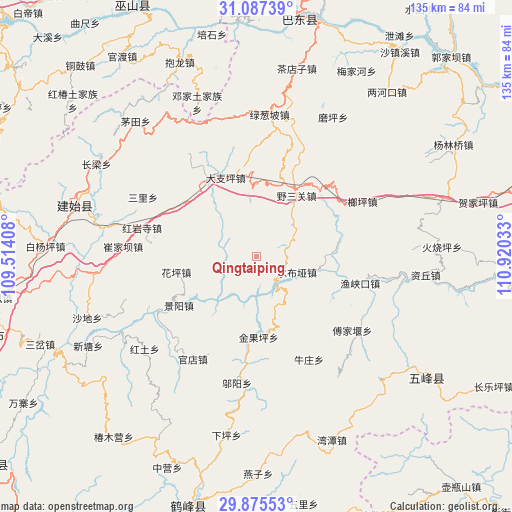
Qingtaiping GPS coordinates[2]
30° 29' 0.06" North, 110° 13' 1.92" East
| Map corner | latitude | longitude |
|---|---|---|
| Upper-left | 31.08739°, | 109.51408° |
| Center: | 30.48335°, | 110.2172° |
| Lower-right: | 29.87553°, | 110.92033° |
| Map W x H: | 134.7×134.7 km | = 83.7×83.7mi |
| max Lat: | 53.31946° ⇑49.8% North |
| Qingtaiping: | 30.48335° |
| min Lat: | ⇓50.2% South 18.22056° |
| min Long | Qingtaiping | max Long |
| 75.07348° | 110.2172° | 134.28917° |
| W 29.7%⇐ | ⇒70.3% E |
Elevation
Elevation of Qingtaiping is 1143 m = 3750 ft, and this is 658.2 m = 2159 ft above average elevation for this country.
| Max E: |
5622 m = 18445 ft | 12.6% |
| Qingtaiping | 1143 m 3750 ft | |
| Avg. | 484.8 m = 1591 ft | |
Min E: |
-3 m = -10 ft | 87.4% |
See also: China elevation on elevation.city.
Geographical zone
Qingtaiping is located in North temperate zone (between Tropic of Cancer and the Arctic Circle). Distance of this Northern Tropic circle is 783.5 km =486.8 mi to South.| Distance of | km | miles | from Qingtaiping |
|---|---|---|---|
| North Pole | 6617.6 | 4112 | to North |
| Arctic Circle | 4011.7 | 2492.8 | to North |
| Tropic Cancer | 783.5 | 486.8 | to South |
| Equator | 3389.4 | 2106.1 | to South |


Nearby cities:
15 places around Qingtaiping: (largest is in red/bold)
• Dazhiping
22.2 km =13.8 mi,  338°
338°
• Fujiayan
31.6 km =19.6 mi,  127°
127°
• Gaoping
24 km =14.9 mi,  326°
326°
• Guandian
31.7 km =19.7 mi,  211°
211°
• Hongyansi
31 km =19.3 mi,  283°
283°
• Huaping
22.4 km =13.9 mi,  258°
258°
• Jinguoping
21.3 km =13.2 mi,  178°
178°
• Jingyang
24.2 km =15 mi,  238°
238°
• Langping
31.3 km =19.4 mi,  62°
62°
• Majiagou
21.3 km =13.2 mi, 178°
• Niuzhuang
30.4 km =18.9 mi,  153°
153°
• Shangcunba
32.8 km =20.4 mi,  226°
226°
• Shuibuya
11.7 km =7.3 mi,  112°
112°
• Yesanguan
18.1 km =11.2 mi,  34°
34°
• Yuxiakou
28.1 km =17.5 mi,  104°
104°
Sources, notices
• [Note1] Compared only with cities in China existing in our database
• [Src1] Map data: © OpenStreetMap contributors (CC-BY-SA)
• [Src2] Other city data from geonames.org with taken over terms of usage.
• [Src3] Geographical zone / Annual Mean Temperature by Robert A. Rohde @ Wikipedia
