Hongyansi geodata
Hongyansi (Hubei) is a seat of a fourth-order administrative division; located in China in Asia/Shanghai (GMT+8) time zone. In our database, there are 1268 cities with bigger population. Compared to other cities in China, 50.8% of cities are located further ↓South; 71.8% of cities are located further →East and 83.9% of cities have lower elevation than Hongyansi. Note1


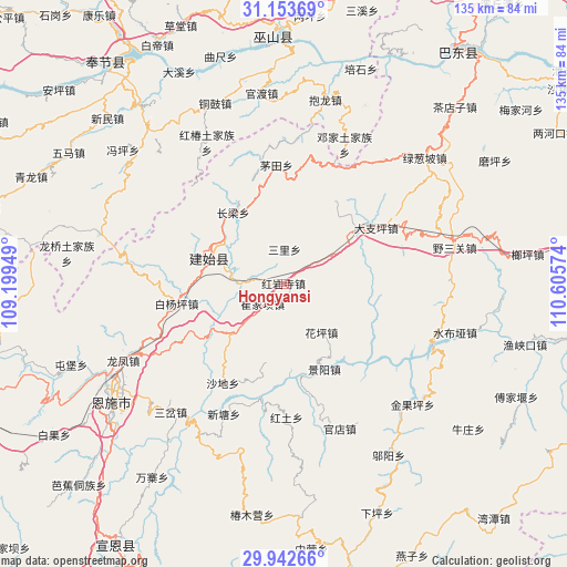
Hongyansi GPS coordinates[2]
30° 33' 0.216" North, 109° 54' 9.396" East
| Map corner | latitude | longitude |
|---|---|---|
| Upper-left | 31.15369°, | 109.19949° |
| Center: | 30.55006°, | 109.90261° |
| Lower-right: | 29.94266°, | 110.60574° |
| Map W x H: | 134.7×134.7 km | = 83.7×83.7mi |
| max Lat: | 53.31946° ⇑49.2% North |
| Hongyansi: | 30.55006° |
| min Lat: | ⇓50.8% South 18.22056° |
| min Long | Hongyansi | max Long |
| 75.07348° | 109.90261° | 134.28917° |
| W 28.2%⇐ | ⇒71.8% E |
Elevation
Elevation of Hongyansi is 912 m = 2992 ft, and this is 427.2 m = 1402 ft above average elevation for this country.
| Max E: |
5622 m = 18445 ft | 16.1% |
| Hongyansi | 912 m 2992 ft | |
| Avg. | 484.8 m = 1591 ft | |
Min E: |
-3 m = -10 ft | 83.9% |
See also: China elevation on elevation.city.
Geographical zone
Hongyansi is located in North temperate zone (between Tropic of Cancer and the Arctic Circle). Distance of this Northern Tropic circle is 790.9 km =491.4 mi to South.| Distance of | km | miles | from Hongyansi |
|---|---|---|---|
| North Pole | 6610.2 | 4107.4 | to North |
| Arctic Circle | 4004.3 | 2488.2 | to North |
| Tropic Cancer | 790.9 | 491.4 | to South |
| Equator | 3396.8 | 2110.7 | to South |


Nearby cities:
15 places around Hongyansi: (largest is in red/bold)
• Baiyangping
26 km =16.2 mi,  256°
256°
• Changliang
20.8 km =12.9 mi,  324°
324°
• Cuijiaba
7 km =4.3 mi,  226°
226°
• Dazhiping
25.6 km =15.9 mi,  58°
58°
• Gaoping
21.1 km =13.1 mi,  53°
53°
• Heshuiping
5.7 km =3.5 mi,  303°
303°
• Hongtu
31.8 km =19.8 mi,  179°
179°
• Huaping
14.4 km =8.9 mi,  145°
145°
• Jingyang
22.4 km =13.9 mi, 154°
• Maotian
28.2 km =17.5 mi,  356°
356°
• Qingtaiping
31 km =19.3 mi,  103°
103°
• Sanli
8.2 km =5.1 mi,  1°
1°
• Shadi
27.8 km =17.3 mi,  211°
211°
• Shangcunba
30.4 km =18.9 mi,  168°
168°
• Yezhou
18.2 km =11.3 mi,  289°
289°
Sources, notices
• [Note1] Compared only with cities in China existing in our database
• [Src1] Map data: © OpenStreetMap contributors (CC-BY-SA)
• [Src2] Other city data from geonames.org with taken over terms of usage.
• [Src3] Geographical zone / Annual Mean Temperature by Robert A. Rohde @ Wikipedia
