Jinguoping geodata
Jinguoping (Hubei) is a seat of a fourth-order administrative division; located in China in Asia/Shanghai (GMT+8) time zone. In our database, there are 1268 cities with bigger population. Compared to other cities in China, 51.3% of cities are located further ↑North; 70.3% of cities are located further →East and 76.6% of cities have lower elevation than Jinguoping. Note1


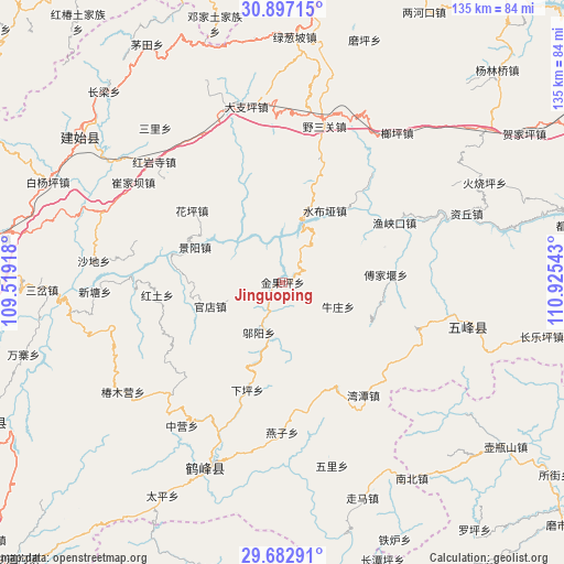
Jinguoping GPS coordinates[2]
30° 17' 30.876" North, 110° 13' 20.28" East
| Map corner | latitude | longitude |
|---|---|---|
| Upper-left | 30.89715°, | 109.51918° |
| Center: | 30.29191°, | 110.2223° |
| Lower-right: | 29.68291°, | 110.92543° |
| Map W x H: | 135×135 km | = 83.9×83.9mi |
| max Lat: | 53.31946° ⇑51.3% North |
| Jinguoping: | 30.29191° |
| min Lat: | ⇓48.7% South 18.22056° |
| min Long | Jinguoping | max Long |
| 75.07348° | 110.2223° | 134.28917° |
| W 29.7%⇐ | ⇒70.3% E |
Elevation
Elevation of Jinguoping is 564 m = 1850 ft, and this is 79.2 m = 260 ft above average elevation for this country.
| Max E: |
5622 m = 18445 ft | 23.4% |
| Jinguoping | 564 m 1850 ft | |
| Avg. | 484.8 m = 1591 ft | |
Min E: |
-3 m = -10 ft | 76.6% |
See also: China elevation on elevation.city.
Geographical zone
Jinguoping is located in North temperate zone (between Tropic of Cancer and the Arctic Circle). Distance of this Northern Tropic circle is 762.2 km =473.6 mi to South.| Distance of | km | miles | from Jinguoping |
|---|---|---|---|
| North Pole | 6638.9 | 4125.2 | to North |
| Arctic Circle | 4033 | 2506 | to North |
| Tropic Cancer | 762.2 | 473.6 | to South |
| Equator | 3368.1 | 2092.8 | to South |


Nearby cities:
15 places around Jinguoping: (largest is in red/bold)
• Caihua
23.4 km =14.5 mi,  111°
111°
• Fujiayan
24.7 km =15.3 mi,  85°
85°
• Guandian
18 km =11.2 mi,  251°
251°
• Hongtu
30.5 km =19 mi,  264°
264°
• Huaping
28.1 km =17.5 mi,  306°
306°
• Jingyang
22.7 km =14.1 mi,  291°
291°
• Majiagou
0 km =0 mi,  232°
232°
• Niuzhuang
14.5 km =9 mi, 113°
• Qingtaiping
21.3 km =13.2 mi,  358°
358°
• Shangcunba
24.5 km =15.2 mi,  267°
267°
• Shuibuya
19.7 km =12.2 mi,  31°
31°
• Wantan
33.3 km =20.7 mi,  144°
144°
• Wuyang
13.5 km =8.4 mi,  205°
205°
• Yanzi
36 km =22.4 mi,  180°
180°
• Yuxiakou
30.3 km =18.8 mi,  61°
61°
Sources, notices
• [Note1] Compared only with cities in China existing in our database
• [Src1] Map data: © OpenStreetMap contributors (CC-BY-SA)
• [Src2] Other city data from geonames.org with taken over terms of usage.
• [Src3] Geographical zone / Annual Mean Temperature by Robert A. Rohde @ Wikipedia
