Chengguan geodata
Chengguan (Inner Mongolia) is a seat of a third-order administrative division; located in China in Asia/Shanghai (GMT+8) time zone. In our database, there are 1268 cities with bigger population. Compared to other cities in China, 86.1% of cities are located further ↓South; 64.2% of cities are located further →East and 87.5% of cities have lower elevation than Chengguan. Note1


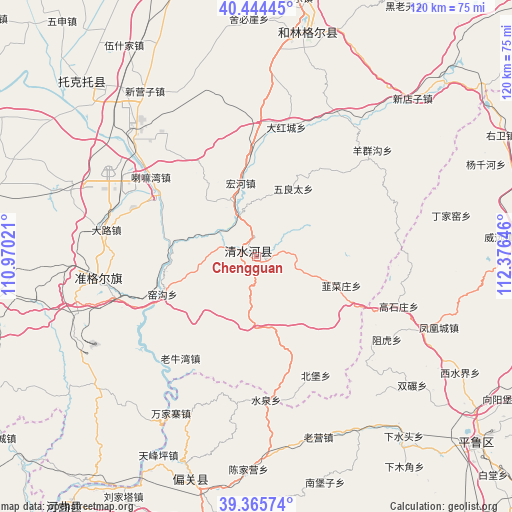
Chengguan GPS coordinates[2]
39° 54' 25.992" North, 111° 40' 23.988" East
| Map corner | latitude | longitude |
|---|---|---|
| Upper-left | 40.44445°, | 110.97021° |
| Center: | 39.90722°, | 111.67333° |
| Lower-right: | 39.36574°, | 112.37646° |
| Map W x H: | 119.9×119.9 km | = 74.5×74.5mi |
| max Lat: | 53.31946° ⇑13.9% North |
| Chengguan: | 39.90722° |
| min Lat: | ⇓86.1% South 18.22056° |
| min Long | Chengguan | max Long |
| 75.07348° | 111.67333° | 134.28917° |
| W 35.8%⇐ | ⇒64.2% E |
Elevation
Elevation of Chengguan is 1152 m = 3780 ft, and this is 667.2 m = 2189 ft above average elevation for this country.
| Max E: |
5622 m = 18445 ft | 12.5% |
| Chengguan | 1152 m 3780 ft | |
| Avg. | 484.8 m = 1591 ft | |
Min E: |
-3 m = -10 ft | 87.5% |
See also: China elevation on elevation.city.
Geographical zone
Chengguan is located in North temperate zone (between Tropic of Cancer and the Arctic Circle). Distance of this Northern Tropic circle is 1831.3 km =1137.9 mi to South.| Distance of | km | miles | from Chengguan |
|---|---|---|---|
| North Pole | 5569.8 | 3460.9 | to North |
| Arctic Circle | 2963.9 | 1841.7 | to North |
| Tropic Cancer | 1831.3 | 1137.9 | to South |
| Equator | 4437.3 | 2757.2 | to South |


Nearby cities:
15 places around Chengguan: (largest is in red/bold)
• Beibao
31.8 km =19.8 mi,  153°
153°
• Dongmugou
17.8 km =11.1 mi,  251°
251°
• Fenghuangcheng
46 km =28.6 mi,  111°
111°
• Hougaoshizhuang
35.9 km =22.3 mi,  104°
104°
• Jiucaizhuang
20.8 km =12.9 mi, 110°
• Lamawan
31.2 km =19.4 mi,  307°
307°
• Nuanquan
23.8 km =14.8 mi,  167°
167°
• Pendiqing
28.4 km =17.6 mi,  82°
82°
• Shantaizi
30.6 km =19 mi,  216°
216°
• Wuliangtai
18.1 km =11.2 mi,  30°
30°
• Xiaomiaozi
2 km =1.2 mi, 306°
• Xuejiawan
38.9 km =24.2 mi,  263°
263°
• Yangjiayao
12.6 km =7.8 mi,  56°
56°
• Yaogou
23 km =14.3 mi,  243°
243°
• Zuhu
36.2 km =22.5 mi,  122°
122°
Sources, notices
• [Note1] Compared only with cities in China existing in our database
• [Src1] Map data: © OpenStreetMap contributors (CC-BY-SA)
• [Src2] Other city data from geonames.org with taken over terms of usage.
• [Src3] Geographical zone / Annual Mean Temperature by Robert A. Rohde @ Wikipedia
