Shantaizi geodata
Shantaizi (Inner Mongolia) is a seat of a fourth-order administrative division; located in China in Asia/Shanghai (GMT+8) time zone. In our database, there are 1268 cities with bigger population. Compared to other cities in China, 85.3% of cities are located further ↓South; 65.2% of cities are located further →East and 89% of cities have lower elevation than Shantaizi. Note1


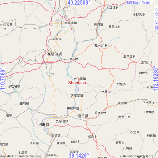
Shantaizi GPS coordinates[2]
39° 41' 9.996" North, 111° 27' 34.992" East
| Map corner | latitude | longitude |
|---|---|---|
| Upper-left | 40.22508°, | 110.7566° |
| Center: | 39.68611°, | 111.45972° |
| Lower-right: | 39.1429°, | 112.16285° |
| Map W x H: | 120.3×120.3 km | = 74.8×74.8mi |
| max Lat: | 53.31946° ⇑14.7% North |
| Shantaizi: | 39.68611° |
| min Lat: | ⇓85.3% South 18.22056° |
| min Long | Shantaizi | max Long |
| 75.07348° | 111.45972° | 134.28917° |
| W 34.8%⇐ | ⇒65.2% E |
Elevation
Elevation of Shantaizi is 1272 m = 4173 ft, and this is 787.2 m = 2583 ft above average elevation for this country.
| Max E: |
5622 m = 18445 ft | 11% |
| Shantaizi | 1272 m 4173 ft | |
| Avg. | 484.8 m = 1591 ft | |
Min E: |
-3 m = -10 ft | 89% |
See also: China elevation on elevation.city.
Geographical zone
Shantaizi is located in North temperate zone (between Tropic of Cancer and the Arctic Circle). Distance of this Northern Tropic circle is 1806.8 km =1122.7 mi to South.| Distance of | km | miles | from Shantaizi |
|---|---|---|---|
| North Pole | 5594.4 | 3476.2 | to North |
| Arctic Circle | 2988.5 | 1857 | to North |
| Tropic Cancer | 1806.8 | 1122.7 | to South |
| Equator | 4412.7 | 2741.9 | to South |


Nearby cities:
15 places around Shantaizi: (largest is in red/bold)
• Beibao
32.5 km =20.2 mi,  97°
97°
• Chengguan
30.6 km =19 mi,  36°
36°
• Dongmugou
19 km =11.8 mi,  4°
4°
• Jiucaizhuang
41.6 km =25.8 mi,  65°
65°
• Lamawan
44 km =27.3 mi,  351°
351°
• Nuanquan
23.4 km =14.5 mi,  86°
86°
• Shagedu
51.6 km =32.1 mi,  265°
265°
• Wenbi
40.4 km =25.1 mi,  214°
214°
• Wuliangtai
48.7 km =30.3 mi,  34°
34°
• Xiaomiaozi
30.7 km =19.1 mi, 32°
• Xinguan
26.4 km =16.4 mi,  166°
166°
• Xuejiawan
28.6 km =17.8 mi,  314°
314°
• Yangjiayao
42.7 km =26.5 mi, 42°
• Yaogou
14.5 km =9 mi, 350°
• Zuhu
49.1 km =30.5 mi,  84°
84°
Sources, notices
• [Note1] Compared only with cities in China existing in our database
• [Src1] Map data: © OpenStreetMap contributors (CC-BY-SA)
• [Src2] Other city data from geonames.org with taken over terms of usage.
• [Src3] Geographical zone / Annual Mean Temperature by Robert A. Rohde @ Wikipedia
