Xuejiawan geodata
Xuejiawan (Inner Mongolia) is a seat of a third-order administrative division; located in China in Asia/Shanghai (GMT+8) time zone. In our database, there are 1268 cities with bigger population. Compared to other cities in China, 85.9% of cities are located further ↓South; 66.2% of cities are located further →East and 87.3% of cities have lower elevation than Xuejiawan. Note1


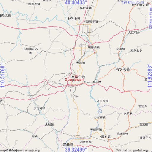
Xuejiawan GPS coordinates[2]
39° 52' 0.408" North, 111° 13' 14.88" East
| Map corner | latitude | longitude |
|---|---|---|
| Upper-left | 40.40433°, | 110.51768° |
| Center: | 39.86678°, | 111.2208° |
| Lower-right: | 39.32499°, | 111.92393° |
| Map W x H: | 120×120 km | = 74.6×74.6mi |
| max Lat: | 53.31946° ⇑14.1% North |
| Xuejiawan: | 39.86678° |
| min Lat: | ⇓85.9% South 18.22056° |
| min Long | Xuejiawan | max Long |
| 75.07348° | 111.2208° | 134.28917° |
| W 33.8%⇐ | ⇒66.2% E |
Elevation
Elevation of Xuejiawan is 1138 m = 3734 ft, and this is 653.2 m = 2143 ft above average elevation for this country.
| Max E: |
5622 m = 18445 ft | 12.7% |
| Xuejiawan | 1138 m 3734 ft | |
| Avg. | 484.8 m = 1591 ft | |
Min E: |
-3 m = -10 ft | 87.3% |
See also: China elevation on elevation.city.
Geographical zone
Xuejiawan is located in North temperate zone (between Tropic of Cancer and the Arctic Circle). Distance of this Northern Tropic circle is 1826.9 km =1135.2 mi to South.| Distance of | km | miles | from Xuejiawan |
|---|---|---|---|
| North Pole | 5574.3 | 3463.7 | to North |
| Arctic Circle | 2968.4 | 1844.5 | to North |
| Tropic Cancer | 1826.9 | 1135.2 | to South |
| Equator | 4432.8 | 2754.4 | to South |


Nearby cities:
15 places around Xuejiawan: (largest is in red/bold)
• Beibao
57.9 km =36 mi,  114°
114°
• Chengguan
38.9 km =24.2 mi,  83°
83°
• Dongmugou
21.8 km =13.5 mi,  92°
92°
• Jiucaizhuang
58.2 km =36.2 mi, 92°
• Lamawan
27.1 km =16.8 mi,  30°
30°
• Nuanquan
47.6 km =29.6 mi, 113°
• Pendiqing
67.3 km =41.8 mi, 82°
• Shagedu
39.4 km =24.5 mi,  231°
231°
• Shantaizi
28.6 km =17.8 mi,  134°
134°
• Wenbi
53.4 km =33.2 mi,  182°
182°
• Wuliangtai
51.9 km =32.2 mi,  67°
67°
• Xiaomiaozi
37.4 km =23.2 mi, 81°
• Xinguan
52.9 km =32.9 mi,  149°
149°
• Yangjiayao
50.4 km =31.3 mi, 76°
• Yaogou
19 km =11.8 mi, 107°
Sources, notices
• [Note1] Compared only with cities in China existing in our database
• [Src1] Map data: © OpenStreetMap contributors (CC-BY-SA)
• [Src2] Other city data from geonames.org with taken over terms of usage.
• [Src3] Geographical zone / Annual Mean Temperature by Robert A. Rohde @ Wikipedia
