Pingxi geodata
Pingxi (Jiangxi) is a seat of a fourth-order administrative division; located in China in Asia/Shanghai (GMT+8) time zone. In our database, there are 1268 cities with bigger population. Compared to other cities in China, 78.1% of cities are located further ↑North; 59.6% of cities are located further ←West and 64% of cities have lower elevation than Pingxi. Note1


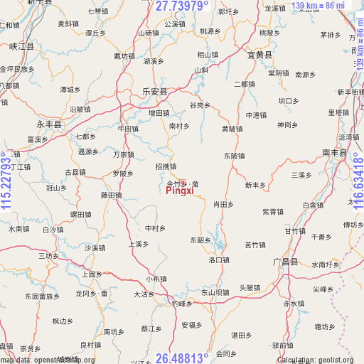
Pingxi GPS coordinates[2]
27° 6' 56.556" North, 115° 55' 51.78" East
| Map corner | latitude | longitude |
|---|---|---|
| Upper-left | 27.73979°, | 115.22793° |
| Center: | 27.11571°, | 115.93105° |
| Lower-right: | 26.48813°, | 116.63418° |
| Map W x H: | 139.2×139.2 km | = 86.5×86.5mi |
| max Lat: | 53.31946° ⇑78.1% North |
| Pingxi: | 27.11571° |
| min Lat: | ⇓21.9% South 18.22056° |
| min Long | Pingxi | max Long |
| 75.07348° | 115.93105° | 134.28917° |
| W 59.6%⇐ | ⇒40.4% E |
Elevation
Elevation of Pingxi is 310 m = 1017 ft, and this is 174.8 m = 573 ft below average elevation for this country.
| Max E: |
5622 m = 18445 ft | 36% |
| Avg. | 484.8 m = 1591 ft | |
| Pingxi | 310 m = 1017 ft | |
Min E: |
-3 m = -10 ft | 64% |
See also: China elevation on elevation.city.
Geographical zone
Pingxi is located in North temperate zone (between Tropic of Cancer and the Arctic Circle). Distance of this Northern Tropic circle is 409.1 km =254.2 mi to South.| Distance of | km | miles | from Pingxi |
|---|---|---|---|
| North Pole | 6992.1 | 4344.7 | to North |
| Arctic Circle | 4386.2 | 2725.5 | to North |
| Tropic Cancer | 409.1 | 254.2 | to South |
| Equator | 3015 | 1873.4 | to South |


Nearby cities:
15 places around Pingxi: (largest is in red/bold)
• Dongbei
22.4 km =13.9 mi,  62°
62°
• Dongshao
20.8 km =12.9 mi,  159°
159°
• Huping
20 km =12.4 mi,  295°
295°
• Jinzhu
11.1 km =6.9 mi,  200°
200°
• Luobei
22.9 km =14.2 mi,  279°
279°
• Nancun
21.6 km =13.4 mi,  357°
357°
• Shima
22.9 km =14.2 mi,  234°
234°
• Taotang
24.3 km =15.1 mi,  257°
257°
• Tengtian
27.3 km =17 mi, 261°
• Wanchong
25.1 km =15.6 mi, 295°
• Wangxian
16.8 km =10.4 mi,  339°
339°
• Xiaotian
18 km =11.2 mi,  117°
117°
• Xinfeng
27.9 km =17.3 mi,  91°
91°
• Zhaoxie
8.3 km =5.2 mi,  314°
314°
• Zhongcun
20.1 km =12.5 mi,  210°
210°
Sources, notices
• [Note1] Compared only with cities in China existing in our database
• [Src1] Map data: © OpenStreetMap contributors (CC-BY-SA)
• [Src2] Other city data from geonames.org with taken over terms of usage.
• [Src3] Geographical zone / Annual Mean Temperature by Robert A. Rohde @ Wikipedia
