Pingluo geodata
Pingluo (Gansu) is a seat of a fourth-order administrative division; located in China in Asia/Shanghai (GMT+8) time zone. In our database, there are 1268 cities with bigger population. Compared to other cities in China, 68.2% of cities are located further ↓South; 88.4% of cities are located further →East and 86.7% of cities have lower elevation than Pingluo. Note1


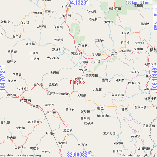
Pingluo GPS coordinates[2]
33° 32' 55.68" North, 105° 24' 37.188" East
| Map corner | latitude | longitude |
|---|---|---|
| Upper-left | 34.1328°, | 104.70721° |
| Center: | 33.5488°, | 105.41033° |
| Lower-right: | 32.96082°, | 106.11346° |
| Map W x H: | 130.3×130.3 km | = 81×81mi |
| max Lat: | 53.31946° ⇑31.8% North |
| Pingluo: | 33.5488° |
| min Lat: | ⇓68.2% South 18.22056° |
| min Long | Pingluo | max Long |
| 75.07348° | 105.41033° | 134.28917° |
| W 11.6%⇐ | ⇒88.4% E |
Elevation
Elevation of Pingluo is 1094 m = 3589 ft, and this is 609.2 m = 1999 ft above average elevation for this country.
| Max E: |
5622 m = 18445 ft | 13.3% |
| Pingluo | 1094 m 3589 ft | |
| Avg. | 484.8 m = 1591 ft | |
Min E: |
-3 m = -10 ft | 86.7% |
See also: China elevation on elevation.city.
Geographical zone
Pingluo is located in North temperate zone (between Tropic of Cancer and the Arctic Circle). Distance of this Northern Tropic circle is 1124.4 km =698.7 mi to South.| Distance of | km | miles | from Pingluo |
|---|---|---|---|
| North Pole | 6276.8 | 3900.2 | to North |
| Arctic Circle | 3670.9 | 2281 | to North |
| Tropic Cancer | 1124.4 | 698.7 | to South |
| Equator | 3730.3 | 2317.9 | to South |


Nearby cities:
15 places around Pingluo: (largest is in red/bold)
• Changba
13.6 km =8.5 mi,  170°
170°
• Dabao
17.7 km =11 mi,  119°
119°
• Douping
6.2 km =3.9 mi,  125°
125°
• Foya
17.7 km =11 mi,  225°
225°
• Gongji
15.3 km =9.5 mi,  135°
135°
• Huangchen
18.1 km =11.2 mi,  77°
77°
• Lishan
14.6 km =9.1 mi,  89°
89°
• Longba
13.7 km =8.5 mi,  308°
308°
• Sitai
19.8 km =12.3 mi,  110°
110°
• Suochi
14.4 km =8.9 mi,  41°
41°
• Suyuan
14.4 km =8.9 mi,  15°
15°
• Taishi
8.5 km =5.3 mi,  26°
26°
• Wangguan
10.9 km =6.8 mi,  204°
204°
• Xiaochuan
20.3 km =12.6 mi, 43°
• Xiongchi
17.6 km =10.9 mi,  205°
205°
Sources, notices
• [Note1] Compared only with cities in China existing in our database
• [Src1] Map data: © OpenStreetMap contributors (CC-BY-SA)
• [Src2] Other city data from geonames.org with taken over terms of usage.
• [Src3] Geographical zone / Annual Mean Temperature by Robert A. Rohde @ Wikipedia
