Longba geodata
Longba (Gansu) is a seat of a fourth-order administrative division; located in China in Asia/Shanghai (GMT+8) time zone. In our database, there are 1268 cities with bigger population. Compared to other cities in China, 68.4% of cities are located further ↓South; 88.6% of cities are located further →East and 90.7% of cities have lower elevation than Longba. Note1


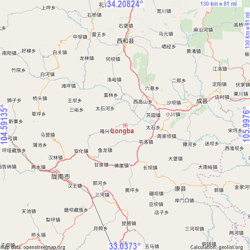
Longba GPS coordinates[2]
33° 37' 29.136" North, 105° 17' 40.092" East
| Map corner | latitude | longitude |
|---|---|---|
| Upper-left | 34.20824°, | 104.59135° |
| Center: | 33.62476°, | 105.29447° |
| Lower-right: | 33.0373°, | 105.9976° |
| Map W x H: | 130.2×130.2 km | = 80.9×80.9mi |
| max Lat: | 53.31946° ⇑31.6% North |
| Longba: | 33.62476° |
| min Lat: | ⇓68.4% South 18.22056° |
| min Long | Longba | max Long |
| 75.07348° | 105.29447° | 134.28917° |
| W 11.4%⇐ | ⇒88.6% E |
Elevation
Elevation of Longba is 1423 m = 4669 ft, and this is 938.2 m = 3078 ft above average elevation for this country.
| Max E: |
5622 m = 18445 ft | 9.3% |
| Longba | 1423 m 4669 ft | |
| Avg. | 484.8 m = 1591 ft | |
Min E: |
-3 m = -10 ft | 90.7% |
See also: China elevation on elevation.city.
Geographical zone
Longba is located in North temperate zone (between Tropic of Cancer and the Arctic Circle). Distance of this Northern Tropic circle is 1132.8 km =703.9 mi to South.| Distance of | km | miles | from Longba |
|---|---|---|---|
| North Pole | 6268.3 | 3894.9 | to North |
| Arctic Circle | 3662.5 | 2275.8 | to North |
| Tropic Cancer | 1132.8 | 703.9 | to South |
| Equator | 3738.7 | 2323.1 | to South |


Nearby cities:
15 places around Longba: (largest is in red/bold)
• Daqiao
13.6 km =8.5 mi,  353°
353°
• Douping
19.8 km =12.3 mi,  127°
127°
• Haolin
17.6 km =10.9 mi,  334°
334°
• Longxing
9.8 km =6.1 mi,  252°
252°
• Pingluo
13.7 km =8.5 mi, 128°
• Shixia
19.6 km =12.2 mi,  26°
26°
• Suochi
20.4 km =12.7 mi,  83°
83°
• Suyuan
15.6 km =9.7 mi,  69°
69°
• Taishi
14.6 km =9.1 mi,  93°
93°
• Taishihe
13.8 km =8.6 mi,  310°
310°
• Wangguan
19.4 km =12.1 mi,  161°
161°
• Xigaoshan
15 km =9.3 mi,  35°
35°
• Xiji
17.6 km =10.9 mi, 354°
• Yulong
16.5 km =10.3 mi,  219°
219°
• Zhifang
20.8 km =12.9 mi,  57°
57°
Sources, notices
• [Note1] Compared only with cities in China existing in our database
• [Src1] Map data: © OpenStreetMap contributors (CC-BY-SA)
• [Src2] Other city data from geonames.org with taken over terms of usage.
• [Src3] Geographical zone / Annual Mean Temperature by Robert A. Rohde @ Wikipedia
