Panzhuang geodata
Panzhuang (Tianjin) is a seat of a fourth-order administrative division; located in China in Asia/Shanghai (GMT+8) time zone. With population of 4,864 people, there are 874 cities with bigger population in this country. Compared to other cities in China, 84.2% of cities are located further ↓South; 68.6% of cities are located further ←West and 89.9% of cities have higher elevation than Panzhuang. Note1


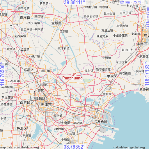
Panzhuang GPS coordinates[2]
39° 20' 21.948" North, 117° 28' 5.52" East
| Map corner | latitude | longitude |
|---|---|---|
| Upper-left | 39.88111°, | 116.76508° |
| Center: | 39.33943°, | 117.4682° |
| Lower-right: | 38.79352°, | 118.17133° |
| Map W x H: | 120.9×120.9 km | = 75.1×75.1mi |
| max Lat: | 53.31946° ⇑15.8% North |
| Panzhuang: | 39.33943° |
| min Lat: | ⇓84.2% South 18.22056° |
| min Long | Panzhuang | max Long |
| 75.07348° | 117.4682° | 134.28917° |
| W 68.6%⇐ | ⇒31.4% E |
Elevation
Elevation of Panzhuang is 10 m = 33 ft, and this is 474.8 m = 1558 ft below average elevation for this country.
| Max E: |
5622 m = 18445 ft | 89.9% |
| Avg. | 484.8 m = 1591 ft | |
| Panzhuang | 10 m = 33 ft | |
Min E: |
-3 m = -10 ft | 10.1% |
See also: China elevation on elevation.city.
Geographical zone
Panzhuang is located in North temperate zone (between Tropic of Cancer and the Arctic Circle). Distance of this Northern Tropic circle is 1768.2 km =1098.7 mi to South.| Distance of | km | miles | from Panzhuang |
|---|---|---|---|
| North Pole | 5632.9 | 3500.1 | to North |
| Arctic Circle | 3027 | 1880.9 | to North |
| Tropic Cancer | 1768.2 | 1098.7 | to South |
| Equator | 4374.1 | 2717.9 | to South |


Nearby cities:
15 places around Panzhuang: (largest is in red/bold)
• Beihuaidian
12.2 km =7.6 mi,  137°
137°
• Biaokou
7.5 km =4.7 mi,  102°
102°
• Chitu
16.1 km =10 mi,  200°
200°
• Dabaizhuang
13.9 km =8.6 mi,  327°
327°
• Datangzhuang
7.3 km =4.5 mi,  336°
336°
• Dawangtai
7.3 km =4.5 mi,  168°
168°
• Dongditou
11.5 km =7.1 mi,  225°
225°
• Dongjituo
12.9 km =8 mi,  44°
44°
• Erwangzhuang
11.4 km =7.1 mi,  300°
300°
• Huangzhuang
16.3 km =10.1 mi,  13°
13°
• Huozhuangzi
14.3 km =8.9 mi,  248°
248°
• Liukuaizhuang
15 km =9.3 mi, 227°
• Xiditou
14.1 km =8.8 mi, 227°
• Xitangtuo
2.6 km =1.6 mi, 137°
• Zaojiacheng
7.5 km =4.7 mi, 201°
Sources, notices
• [Note1] Compared only with cities in China existing in our database
• [Src1] Map data: © OpenStreetMap contributors (CC-BY-SA)
• [Src2] Other city data from geonames.org with taken over terms of usage.
• [Src3] Geographical zone / Annual Mean Temperature by Robert A. Rohde @ Wikipedia
