Dongditou geodata
Dongditou (Tianjin) is a populated place; located in China in Asia/Shanghai (GMT+8) time zone. With population of 5,925 people, there are 849 cities with bigger population in this country. Compared to other cities in China, 84% of cities are located further ↓South; 68.2% of cities are located further ←West and 94.3% of cities have higher elevation than Dongditou. Note1


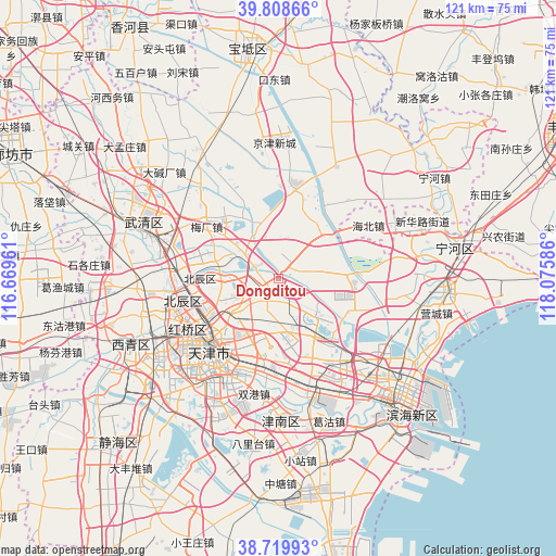
Dongditou GPS coordinates[2]
39° 15' 59.076" North, 117° 22' 21.828" East
| Map corner | latitude | longitude |
|---|---|---|
| Upper-left | 39.80866°, | 116.66961° |
| Center: | 39.26641°, | 117.37273° |
| Lower-right: | 38.71993°, | 118.07586° |
| Map W x H: | 121.1×121.1 km | = 75.2×75.2mi |
| max Lat: | 53.31946° ⇑16% North |
| Dongditou: | 39.26641° |
| min Lat: | ⇓84% South 18.22056° |
| min Long | Dongditou | max Long |
| 75.07348° | 117.37273° | 134.28917° |
| W 68.2%⇐ | ⇒31.8% E |
Elevation
Elevation of Dongditou is 7 m = 23 ft, and this is 477.8 m = 1568 ft below average elevation for this country.
| Max E: |
5622 m = 18445 ft | 94.3% |
| Avg. | 484.8 m = 1591 ft | |
| Dongditou | 7 m = 23 ft | |
Min E: |
-3 m = -10 ft | 5.7% |
See also: China elevation on elevation.city.
Geographical zone
Dongditou is located in North temperate zone (between Tropic of Cancer and the Arctic Circle). Distance of this Northern Tropic circle is 1760.1 km =1093.7 mi to South.| Distance of | km | miles | from Dongditou |
|---|---|---|---|
| North Pole | 5641 | 3505.2 | to North |
| Arctic Circle | 3035.2 | 1886 | to North |
| Tropic Cancer | 1760.1 | 1093.7 | to South |
| Equator | 4366 | 2712.9 | to South |


Nearby cities:
15 places around Dongditou: (largest is in red/bold)
• Chitu
7.5 km =4.7 mi,  159°
159°
• Dabizhuang
13 km =8.1 mi,  230°
230°
• Dawangtai
9.7 km =6 mi,  84°
84°
• Dazhangzhuang
12.8 km =8 mi,  279°
279°
• Fanzhuang
8.7 km =5.4 mi,  201°
201°
• Huaming
12.8 km =8 mi, 204°
• Huangcaotuo
10.6 km =6.6 mi, 204°
• Huantuo
6.1 km =3.8 mi,  223°
223°
• Huozhuangzi
5.8 km =3.6 mi,  298°
298°
• Liukuaizhuang
3.5 km =2.2 mi, 234°
• Panzhuang
11.5 km =7.1 mi,  45°
45°
• Xiaodian
12.6 km =7.8 mi,  263°
263°
• Xiditou
2.5 km =1.6 mi,  236°
236°
• Xitangtuo
11.7 km =7.3 mi,  57°
57°
• Zaojiacheng
5.6 km =3.5 mi, 77°
Sources, notices
• [Note1] Compared only with cities in China existing in our database
• [Src1] Map data: © OpenStreetMap contributors (CC-BY-SA)
• [Src2] Other city data from geonames.org with taken over terms of usage.
• [Src3] Geographical zone / Annual Mean Temperature by Robert A. Rohde @ Wikipedia
