Nanping geodata
Nanping (Guangdong) is a seat of a fourth-order administrative division; located in China in Asia/Shanghai (GMT+8) time zone. In our database, there are 1268 cities with bigger population. Compared to other cities in China, 96.9% of cities are located further ↑North; 54.4% of cities are located further →East and 92.7% of cities have higher elevation than Nanping. Note1


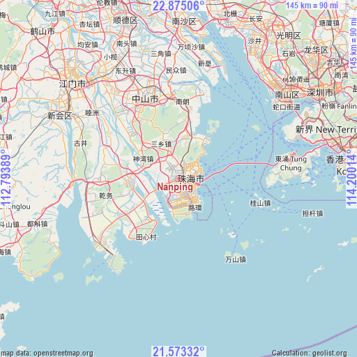
Nanping GPS coordinates[2]
22° 13' 32.52" North, 113° 29' 49.236" East
| Map corner | latitude | longitude |
|---|---|---|
| Upper-left | 22.87506°, | 112.79389° |
| Center: | 22.2257°, | 113.49701° |
| Lower-right: | 21.57332°, | 114.20014° |
| Map W x H: | 144.7×144.7 km | = 89.9×89.9mi |
| max Lat: | 53.31946° ⇑96.9% North |
| Nanping: | 22.2257° |
| min Lat: | ⇓3.1% South 18.22056° |
| min Long | Nanping | max Long |
| 75.07348° | 113.49701° | 134.28917° |
| W 45.6%⇐ | ⇒54.4% E |
Elevation
Elevation of Nanping is 8 m = 26 ft, and this is 476.8 m = 1564 ft below average elevation for this country.
| Max E: |
5622 m = 18445 ft | 92.7% |
| Avg. | 484.8 m = 1591 ft | |
| Nanping | 8 m = 26 ft | |
Min E: |
-3 m = -10 ft | 7.3% |
See also: China elevation on elevation.city.
Geographical zone
Nanping is located in North Torrid zone (between Equator and Tropic of Cancer). Distance of this Northern Tropic circle is 134.7 km =83.7 mi to North.| Distance of | km | miles | from Nanping |
|---|---|---|---|
| North Pole | 7535.8 | 4682.5 | to North |
| Arctic Circle | 4929.9 | 3063.3 | to North |
| Tropic Cancer | 134.7 | 83.7 | to North |
| Equator | 2471.3 | 1535.6 | to South |


Nearby cities:
15 places around Nanping: (largest is in red/bold)
• Banfu
27.5 km =17.1 mi,  318°
318°
• Hongqi
18.1 km =11.2 mi,  241°
241°
• Jida
8.2 km =5.1 mi,  66°
66°
• Jing’an
21.1 km =13.1 mi,  265°
265°
• Nanlang
29.9 km =18.6 mi,  7°
7°
• Qianshan
3.2 km =2 mi,  51°
51°
• Qianwu
28.3 km =17.6 mi,  256°
256°
• Sanxiang
16 km =9.9 mi,  330°
330°
• Sanzao
24.9 km =15.5 mi,  219°
219°
• Shenwan
15 km =9.3 mi,  299°
299°
• Tangjiawan
18.1 km =11.2 mi,  34°
34°
• Tanzhou
4.5 km =2.8 mi, 316°
• Wanzai
4.1 km =2.5 mi,  130°
130°
• Wuguishan
21.1 km =13.1 mi,  340°
340°
• Zhuhai
9.2 km =5.7 mi, 51°
Sources, notices
• [Note1] Compared only with cities in China existing in our database
• [Src1] Map data: © OpenStreetMap contributors (CC-BY-SA)
• [Src2] Other city data from geonames.org with taken over terms of usage.
• [Src3] Geographical zone / Annual Mean Temperature by Robert A. Rohde @ Wikipedia
