Hongtu geodata
Hongtu (Qinghai) is a seat of a fourth-order administrative division; located in China in Asia/Shanghai (GMT+8) time zone. In our database, there are 1268 cities with bigger population. Compared to other cities in China, 80.9% of cities are located further ↓South; 93.9% of cities are located further →East and 97.7% of cities have lower elevation than Hongtu. Note1


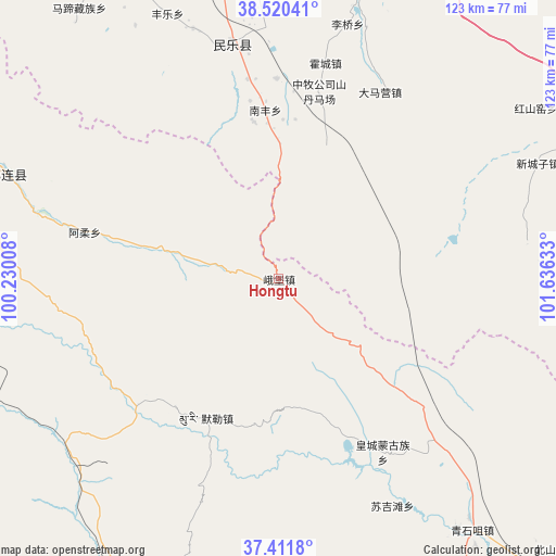
Hongtu GPS coordinates[2]
37° 58' 5.52" North, 100° 55' 59.52" East
| Map corner | latitude | longitude |
|---|---|---|
| Upper-left | 38.52041°, | 100.23008° |
| Center: | 37.9682°, | 100.9332° |
| Lower-right: | 37.4118°, | 101.63633° |
| Map W x H: | 123.3×123.3 km | = 76.6×76.6mi |
| max Lat: | 53.31946° ⇑19.1% North |
| Hongtu: | 37.9682° |
| min Lat: | ⇓80.9% South 18.22056° |
| min Long | Hongtu | max Long |
| 75.07348° | 100.9332° | 134.28917° |
| W 6.1%⇐ | ⇒93.9% E |
Elevation
Elevation of Hongtu is 3442 m = 11293 ft, and this is 2957.2 m = 9702 ft above average elevation for this country.
| Max E: |
5622 m = 18445 ft | 2.3% |
| Hongtu | 3442 m 11293 ft | |
| Avg. | 484.8 m = 1591 ft | |
Min E: |
-3 m = -10 ft | 97.7% |
See also: China elevation on elevation.city.
Geographical zone
Hongtu is located in North temperate zone (between Tropic of Cancer and the Arctic Circle). Distance of this Northern Tropic circle is 1615.7 km =1003.9 mi to South.| Distance of | km | miles | from Hongtu |
|---|---|---|---|
| North Pole | 5785.4 | 3594.9 | to North |
| Arctic Circle | 3179.5 | 1975.6 | to North |
| Tropic Cancer | 1615.7 | 1003.9 | to South |
| Equator | 4221.7 | 2623.2 | to South |


Nearby cities:
15 places around Hongtu: (largest is in red/bold)
• Damaying
50.1 km =31.1 mi,  27°
27°
• Hongshui
52.2 km =32.4 mi,  346°
346°
• Huangcheng
46.3 km =28.8 mi,  149°
149°
• Huazhaizi
64.1 km =39.8 mi,  22°
22°
• Huocheng
49.5 km =30.8 mi,  12°
12°
• Maying
68.4 km =42.5 mi,  89°
89°
• Muri
35.9 km =22.3 mi,  210°
210°
• Nanfeng
38.7 km =24 mi, 353°
• Obo
0.4 km =0.2 mi,  182°
182°
• Qilian
65.1 km =40.5 mi,  291°
291°
• Sanbao
67.1 km =41.7 mi, 348°
• Shunhua
58.8 km =36.5 mi,  341°
341°
• Sujitan
54.9 km =34.1 mi, 154°
• Xinchengzi
63.1 km =39.2 mi,  67°
67°
• Yonggu
45.9 km =28.5 mi,  1°
1°
Sources, notices
• [Note1] Compared only with cities in China existing in our database
• [Src1] Map data: © OpenStreetMap contributors (CC-BY-SA)
• [Src2] Other city data from geonames.org with taken over terms of usage.
• [Src3] Geographical zone / Annual Mean Temperature by Robert A. Rohde @ Wikipedia
