Matou geodata
Matou (Fujian) is a seat of a fourth-order administrative division; located in China in Asia/Shanghai (GMT+8) time zone. In our database, there are 1268 cities with bigger population. Compared to other cities in China, 85.6% of cities are located further ↑North; 72.3% of cities are located further ←West and 71.3% of cities have higher elevation than Matou. Note1


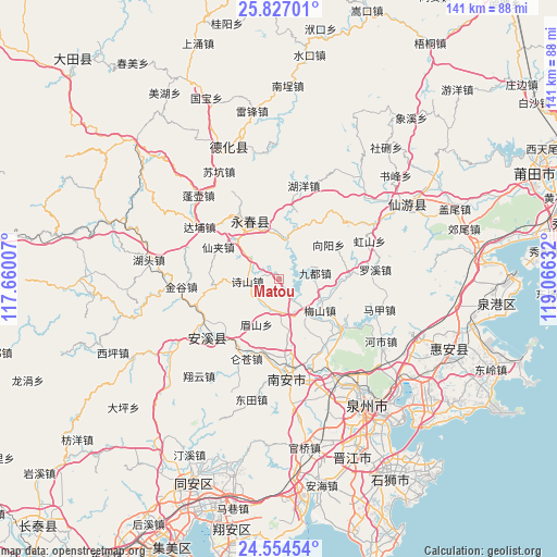
Matou GPS coordinates[2]
25° 11' 32.784" North, 118° 21' 47.484" East
| Map corner | latitude | longitude |
|---|---|---|
| Upper-left | 25.82701°, | 117.66007° |
| Center: | 25.19244°, | 118.36319° |
| Lower-right: | 24.55454°, | 119.06632° |
| Map W x H: | 141.5×141.5 km | = 87.9×87.9mi |
| max Lat: | 53.31946° ⇑85.6% North |
| Matou: | 25.19244° |
| min Lat: | ⇓14.4% South 18.22056° |
| min Long | Matou | max Long |
| 75.07348° | 118.36319° | 134.28917° |
| W 72.3%⇐ | ⇒27.7% E |
Elevation
Elevation of Matou is 47 m = 154 ft, and this is 437.8 m = 1436 ft below average elevation for this country.
| Max E: |
5622 m = 18445 ft | 71.3% |
| Avg. | 484.8 m = 1591 ft | |
| Matou | 47 m = 154 ft | |
Min E: |
-3 m = -10 ft | 28.7% |
See also: China elevation on elevation.city.
Geographical zone
Matou is located in North temperate zone (between Tropic of Cancer and the Arctic Circle). Distance of this Northern Tropic circle is 195.2 km =121.3 mi to South.| Distance of | km | miles | from Matou |
|---|---|---|---|
| North Pole | 7205.9 | 4477.5 | to North |
| Arctic Circle | 4600 | 2858.3 | to North |
| Tropic Cancer | 195.2 | 121.3 | to South |
| Equator | 2801.1 | 1740.5 | to South |


Nearby cities:
15 places around Matou: (largest is in red/bold)
• Cannei
19.9 km =12.4 mi,  227°
227°
• Dongguan
11.4 km =7.1 mi,  357°
357°
• Dongping
13 km =8.1 mi,  346°
346°
• Honglai
19.9 km =12.4 mi,  129°
129°
• Jintao
8.1 km =5 mi,  187°
187°
• Jiudu
9.3 km =5.8 mi,  81°
81°
• Luodong
13.6 km =8.5 mi,  105°
105°
• Meishan
13.1 km =8.1 mi, 127°
• Meishan
13.5 km =8.4 mi,  206°
206°
• Penghua
17 km =10.6 mi,  270°
270°
• Shengxin
17.4 km =10.8 mi,  173°
173°
• Taocheng
14.7 km =9.1 mi,  334°
334°
• Waishan
18 km =11.2 mi,  37°
37°
• Wulijie
18 km =11.2 mi, 328°
• Xianjia
17 km =10.6 mi,  297°
297°
Sources, notices
• [Note1] Compared only with cities in China existing in our database
• [Src1] Map data: © OpenStreetMap contributors (CC-BY-SA)
• [Src2] Other city data from geonames.org with taken over terms of usage.
• [Src3] Geographical zone / Annual Mean Temperature by Robert A. Rohde @ Wikipedia
