Longju geodata
Longju (Chongqing) is a seat of a fourth-order administrative division; located in China in Asia/Shanghai (GMT+8) time zone. In our database, there are 1268 cities with bigger population. Compared to other cities in China, 51.3% of cities are located further ↓South; 78% of cities are located further →East and 67.9% of cities have lower elevation than Longju. Note1


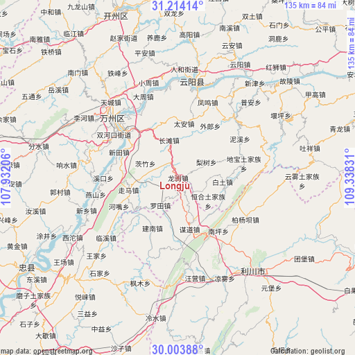
Longju GPS coordinates[2]
30° 36' 39.24" North, 108° 38' 6.648" East
| Map corner | latitude | longitude |
|---|---|---|
| Upper-left | 31.21414°, | 107.93206° |
| Center: | 30.6109°, | 108.63518° |
| Lower-right: | 30.00388°, | 109.33831° |
| Map W x H: | 134.6×134.6 km | = 83.6×83.6mi |
| max Lat: | 53.31946° ⇑48.7% North |
| Longju: | 30.6109° |
| min Lat: | ⇓51.3% South 18.22056° |
| min Long | Longju | max Long |
| 75.07348° | 108.63518° | 134.28917° |
| W 22%⇐ | ⇒78% E |
Elevation
Elevation of Longju is 375 m = 1230 ft, and this is 109.8 m = 360 ft below average elevation for this country.
| Max E: |
5622 m = 18445 ft | 32.1% |
| Avg. | 484.8 m = 1591 ft | |
| Longju | 375 m = 1230 ft | |
Min E: |
-3 m = -10 ft | 67.9% |
See also: China elevation on elevation.city.
Geographical zone
Longju is located in North temperate zone (between Tropic of Cancer and the Arctic Circle). Distance of this Northern Tropic circle is 797.7 km =495.7 mi to South.| Distance of | km | miles | from Longju |
|---|---|---|---|
| North Pole | 6603.4 | 4103.2 | to North |
| Arctic Circle | 3997.6 | 2484 | to North |
| Tropic Cancer | 797.7 | 495.7 | to South |
| Equator | 3403.6 | 2114.9 | to South |


Nearby cities:
15 places around Longju: (largest is in red/bold)
• Baitu
16.9 km =10.5 mi,  95°
95°
• Bayang
23 km =14.3 mi,  354°
354°
• Changtan
14.7 km =9.1 mi, 346°
• Dibao
25.4 km =15.8 mi,  78°
78°
• Henghe
14.4 km =8.9 mi,  127°
127°
• Hezui
25.2 km =15.7 mi,  244°
244°
• Jiannan
21.4 km =13.3 mi,  206°
206°
• Lishu
12.3 km =7.6 mi,  61°
61°
• Luotian
12.8 km =8 mi, 214°
• Moudao
19.9 km =12.4 mi,  167°
167°
• Nanping
25.2 km =15.7 mi,  142°
142°
• Tai’an
20.7 km =12.9 mi,  6°
6°
• Wailang
22.1 km =13.7 mi,  34°
34°
• Xintian
24.4 km =15.2 mi,  293°
293°
• Zouma
19.5 km =12.1 mi,  256°
256°
Sources, notices
• [Note1] Compared only with cities in China existing in our database
• [Src1] Map data: © OpenStreetMap contributors (CC-BY-SA)
• [Src2] Other city data from geonames.org with taken over terms of usage.
• [Src3] Geographical zone / Annual Mean Temperature by Robert A. Rohde @ Wikipedia
