Longgao geodata
Longgao (Shaanxi) is a seat of a fourth-order administrative division; located in China in Asia/Shanghai (GMT+8) time zone. In our database, there are 1268 cities with bigger population. Compared to other cities in China, 74.9% of cities are located further ↓South; 79.4% of cities are located further →East and 87.3% of cities have lower elevation than Longgao. Note1


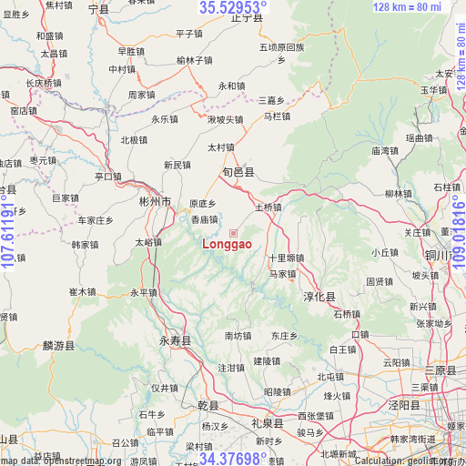
Longgao GPS coordinates[2]
34° 57' 19.008" North, 108° 18' 54.108" East
| Map corner | latitude | longitude |
|---|---|---|
| Upper-left | 35.52953°, | 107.61191° |
| Center: | 34.95528°, | 108.31503° |
| Lower-right: | 34.37698°, | 109.01816° |
| Map W x H: | 128.2×128.2 km | = 79.7×79.7mi |
| max Lat: | 53.31946° ⇑25.1% North |
| Longgao: | 34.95528° |
| min Lat: | ⇓74.9% South 18.22056° |
| min Long | Longgao | max Long |
| 75.07348° | 108.31503° | 134.28917° |
| W 20.6%⇐ | ⇒79.4% E |
Elevation
Elevation of Longgao is 1134 m = 3720 ft, and this is 649.2 m = 2130 ft above average elevation for this country.
| Max E: |
5622 m = 18445 ft | 12.7% |
| Longgao | 1134 m 3720 ft | |
| Avg. | 484.8 m = 1591 ft | |
Min E: |
-3 m = -10 ft | 87.3% |
See also: China elevation on elevation.city.
Geographical zone
Longgao is located in North temperate zone (between Tropic of Cancer and the Arctic Circle). Distance of this Northern Tropic circle is 1280.7 km =795.8 mi to South.| Distance of | km | miles | from Longgao |
|---|---|---|---|
| North Pole | 6120.4 | 3803 | to North |
| Arctic Circle | 3514.5 | 2183.8 | to North |
| Tropic Cancer | 1280.7 | 795.8 | to South |
| Equator | 3886.7 | 2415.1 | to South |


Nearby cities:
15 places around Longgao: (largest is in red/bold)
• Bojia
18.3 km =11.4 mi,  100°
100°
• Changning
15.1 km =9.4 mi,  203°
203°
• Doujia
17.6 km =10.9 mi,  184°
184°
• Guanzhuang
10.8 km =6.7 mi,  125°
125°
• Hujiamiao
9.5 km =5.9 mi,  88°
88°
• Mafang
23.4 km =14.5 mi,  216°
216°
• Majia
16.9 km =10.5 mi, 129°
• Quzi
15.3 km =9.5 mi,  229°
229°
• Runzhen
19.9 km =12.4 mi,  118°
118°
• Shangyi
14.2 km =8.8 mi, 198°
• Shiliyuan
16 km =9.9 mi,  113°
113°
• Xiangmiao
9.1 km =5.7 mi,  297°
297°
• Xinbuzi
21.1 km =13.1 mi,  279°
279°
• Xunyi Chengguanzhen
18 km =11.2 mi,  359°
359°
• Yongtai
16.7 km =10.4 mi,  244°
244°
Sources, notices
• [Note1] Compared only with cities in China existing in our database
• [Src1] Map data: © OpenStreetMap contributors (CC-BY-SA)
• [Src2] Other city data from geonames.org with taken over terms of usage.
• [Src3] Geographical zone / Annual Mean Temperature by Robert A. Rohde @ Wikipedia
