Shiliyuan geodata
Shiliyuan (Shaanxi) is a seat of a fourth-order administrative division; located in China in Asia/Shanghai (GMT+8) time zone. In our database, there are 1268 cities with bigger population. Compared to other cities in China, 74.6% of cities are located further ↓South; 78.7% of cities are located further →East and 87.3% of cities have lower elevation than Shiliyuan. Note1


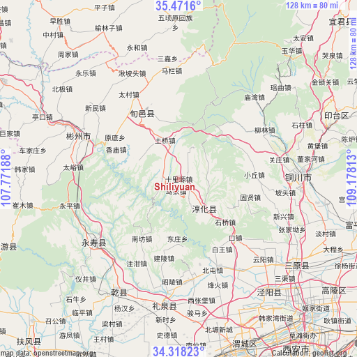
Shiliyuan GPS coordinates[2]
34° 53' 48.984" North, 108° 28' 30" East
| Map corner | latitude | longitude |
|---|---|---|
| Upper-left | 35.4716°, | 107.77188° |
| Center: | 34.89694°, | 108.475° |
| Lower-right: | 34.31823°, | 109.17813° |
| Map W x H: | 128.2×128.2 km | = 79.7×79.7mi |
| max Lat: | 53.31946° ⇑25.4% North |
| Shiliyuan: | 34.89694° |
| min Lat: | ⇓74.6% South 18.22056° |
| min Long | Shiliyuan | max Long |
| 75.07348° | 108.475° | 134.28917° |
| W 21.3%⇐ | ⇒78.7% E |
Elevation
Elevation of Shiliyuan is 1134 m = 3720 ft, and this is 649.2 m = 2130 ft above average elevation for this country.
| Max E: |
5622 m = 18445 ft | 12.7% |
| Shiliyuan | 1134 m 3720 ft | |
| Avg. | 484.8 m = 1591 ft | |
Min E: |
-3 m = -10 ft | 87.3% |
See also: China elevation on elevation.city.
Geographical zone
Shiliyuan is located in North temperate zone (between Tropic of Cancer and the Arctic Circle). Distance of this Northern Tropic circle is 1274.3 km =791.8 mi to South.| Distance of | km | miles | from Shiliyuan |
|---|---|---|---|
| North Pole | 6126.9 | 3807.1 | to North |
| Arctic Circle | 3521 | 2187.8 | to North |
| Tropic Cancer | 1274.3 | 791.8 | to South |
| Equator | 3880.2 | 2411 | to South |


Nearby cities:
15 places around Shiliyuan: (largest is in red/bold)
• Bojia
4.8 km =3 mi,  45°
45°
• Changning
21.8 km =13.5 mi,  250°
250°
• Chigan
21.4 km =13.3 mi,  190°
190°
• Chunhua
14.2 km =8.8 mi,  140°
140°
• Dadian
18.3 km =11.4 mi, 137°
• Dongwu
11.9 km =7.4 mi,  155°
155°
• Doujia
19.4 km =12.1 mi,  235°
235°
• Guanzhuang
5.8 km =3.6 mi,  272°
272°
• Hujiamiao
8.5 km =5.3 mi,  323°
323°
• Longgao
16 km =9.9 mi,  293°
293°
• Majia
4.6 km =2.9 mi,  199°
199°
• Qinhe
11 km =6.8 mi,  76°
76°
• Runzhen
4.2 km =2.6 mi, 135°
• Shangyi
20.4 km =12.7 mi, 250°
• Tiewang
9.2 km =5.7 mi, 76°
Sources, notices
• [Note1] Compared only with cities in China existing in our database
• [Src1] Map data: © OpenStreetMap contributors (CC-BY-SA)
• [Src2] Other city data from geonames.org with taken over terms of usage.
• [Src3] Geographical zone / Annual Mean Temperature by Robert A. Rohde @ Wikipedia
