Runzhen geodata
Runzhen (Shaanxi) is a seat of a fourth-order administrative division; located in China in Asia/Shanghai (GMT+8) time zone. In our database, there are 1268 cities with bigger population. Compared to other cities in China, 74.6% of cities are located further ↓South; 78.5% of cities are located further →East and 86.5% of cities have lower elevation than Runzhen. Note1


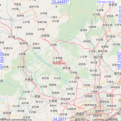
Runzhen GPS coordinates[2]
34° 52' 12" North, 108° 30' 27" East
| Map corner | latitude | longitude |
|---|---|---|
| Upper-left | 35.44485°, | 107.80438° |
| Center: | 34.87°, | 108.5075° |
| Lower-right: | 34.2911°, | 109.21063° |
| Map W x H: | 128.3×128.3 km | = 79.7×79.7mi |
| max Lat: | 53.31946° ⇑25.4% North |
| Runzhen: | 34.87° |
| min Lat: | ⇓74.6% South 18.22056° |
| min Long | Runzhen | max Long |
| 75.07348° | 108.5075° | 134.28917° |
| W 21.5%⇐ | ⇒78.5% E |
Elevation
Elevation of Runzhen is 1084 m = 3556 ft, and this is 599.2 m = 1966 ft above average elevation for this country.
| Max E: |
5622 m = 18445 ft | 13.5% |
| Runzhen | 1084 m 3556 ft | |
| Avg. | 484.8 m = 1591 ft | |
Min E: |
-3 m = -10 ft | 86.5% |
See also: China elevation on elevation.city.
Geographical zone
Runzhen is located in North temperate zone (between Tropic of Cancer and the Arctic Circle). Distance of this Northern Tropic circle is 1271.3 km =789.9 mi to South.| Distance of | km | miles | from Runzhen |
|---|---|---|---|
| North Pole | 6129.9 | 3808.9 | to North |
| Arctic Circle | 3524 | 2189.7 | to North |
| Tropic Cancer | 1271.3 | 789.9 | to South |
| Equator | 3877.2 | 2409.2 | to South |


Nearby cities:
15 places around Runzhen: (largest is in red/bold)
• Bojia
6.3 km =3.9 mi,  4°
4°
• Chigan
19.3 km =12 mi,  200°
200°
• Chunhua
10 km =6.2 mi,  142°
142°
• Dadian
14.1 km =8.8 mi, 138°
• Dongwu
8.1 km =5 mi,  166°
166°
• Doujia
20.6 km =12.8 mi,  246°
246°
• Fangli
21.6 km =13.4 mi,  103°
103°
• Guanzhuang
9.3 km =5.8 mi,  290°
290°
• Hujiamiao
12.7 km =7.9 mi,  320°
320°
• Longgao
19.9 km =12.4 mi,  298°
298°
• Majia
4.7 km =2.9 mi, 253°
• Qinhe
9.6 km =6 mi,  54°
54°
• Shiliyuan
4.2 km =2.6 mi, 315°
• Shiqiao
18.6 km =11.6 mi,  131°
131°
• Tiewang
7.9 km =4.9 mi, 48°
Sources, notices
• [Note1] Compared only with cities in China existing in our database
• [Src1] Map data: © OpenStreetMap contributors (CC-BY-SA)
• [Src2] Other city data from geonames.org with taken over terms of usage.
• [Src3] Geographical zone / Annual Mean Temperature by Robert A. Rohde @ Wikipedia
