Jielong geodata
Jielong (Chongqing) is a seat of a fourth-order administrative division; located in China in Asia/Shanghai (GMT+8) time zone. In our database, there are 1268 cities with bigger population. Compared to other cities in China, 58.6% of cities are located further ↑North; 80.9% of cities are located further →East and 87.2% of cities have lower elevation than Jielong. Note1


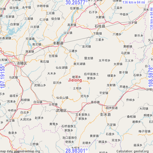
Jielong GPS coordinates[2]
29° 35' 46.464" North, 107° 53' 40.812" East
| Map corner | latitude | longitude |
|---|---|---|
| Upper-left | 30.20577°, | 107.19155° |
| Center: | 29.59624°, | 107.89467° |
| Lower-right: | 28.98301°, | 108.5978° |
| Map W x H: | 136×136 km | = 84.5×84.5mi |
| max Lat: | 53.31946° ⇑58.6% North |
| Jielong: | 29.59624° |
| min Lat: | ⇓41.4% South 18.22056° |
| min Long | Jielong | max Long |
| 75.07348° | 107.89467° | 134.28917° |
| W 19.1%⇐ | ⇒80.9% E |
Elevation
Elevation of Jielong is 1129 m = 3704 ft, and this is 644.2 m = 2114 ft above average elevation for this country.
| Max E: |
5622 m = 18445 ft | 12.8% |
| Jielong | 1129 m 3704 ft | |
| Avg. | 484.8 m = 1591 ft | |
Min E: |
-3 m = -10 ft | 87.2% |
See also: China elevation on elevation.city.
Geographical zone
Jielong is located in North temperate zone (between Tropic of Cancer and the Arctic Circle). Distance of this Northern Tropic circle is 684.9 km =425.6 mi to South.| Distance of | km | miles | from Jielong |
|---|---|---|---|
| North Pole | 6716.3 | 4173.3 | to North |
| Arctic Circle | 4110.4 | 2554.1 | to North |
| Tropic Cancer | 684.9 | 425.6 | to South |
| Equator | 3290.8 | 2044.8 | to South |


Nearby cities:
15 places around Jielong: (largest is in red/bold)
• Canggou
18.2 km =11.3 mi,  156°
156°
• Damu
22.5 km =14 mi,  276°
276°
• Dudu
21.6 km =13.4 mi,  79°
79°
• Gaogu
27.8 km =17.3 mi,  143°
143°
• Houping
13.1 km =8.1 mi,  87°
87°
• Huolu
22.6 km =14 mi,  185°
185°
• Jilong
17.7 km =11 mi,  37°
37°
• Lizi
24.1 km =15 mi,  6°
6°
• Luwu
24.4 km =15.2 mi,  132°
132°
• Nantianhu
11.9 km =7.4 mi, 12°
• Sanba
15.7 km =9.8 mi,  302°
302°
• Sanjian
23.4 km =14.5 mi,  352°
352°
• Shuanghe
17.8 km =11.1 mi,  252°
252°
• Tongzi
6.8 km =4.2 mi, 127°
• Tudi
10.2 km =6.3 mi,  177°
177°
Sources, notices
• [Note1] Compared only with cities in China existing in our database
• [Src1] Map data: © OpenStreetMap contributors (CC-BY-SA)
• [Src2] Other city data from geonames.org with taken over terms of usage.
• [Src3] Geographical zone / Annual Mean Temperature by Robert A. Rohde @ Wikipedia
