Liyuan geodata
Liyuan (Hunan) is a seat of a third-order administrative division; located in China in Asia/Shanghai (GMT+8) time zone. In our database, there are 1268 cities with bigger population. Compared to other cities in China, 60.9% of cities are located further ↑North; 70.6% of cities are located further →East and 65% of cities have lower elevation than Liyuan. Note1


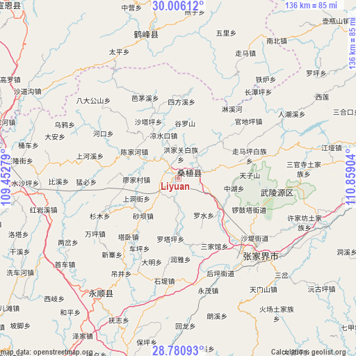
Liyuan GPS coordinates[2]
29° 23' 43.332" North, 110° 9' 21.276" East
| Map corner | latitude | longitude |
|---|---|---|
| Upper-left | 30.00612°, | 109.45279° |
| Center: | 29.39537°, | 110.15591° |
| Lower-right: | 28.78093°, | 110.85904° |
| Map W x H: | 136.2×136.2 km | = 84.6×84.6mi |
| max Lat: | 53.31946° ⇑60.9% North |
| Liyuan: | 29.39537° |
| min Lat: | ⇓39.1% South 18.22056° |
| min Long | Liyuan | max Long |
| 75.07348° | 110.15591° | 134.28917° |
| W 29.4%⇐ | ⇒70.6% E |
Elevation
Elevation of Liyuan is 325 m = 1066 ft, and this is 159.8 m = 524 ft below average elevation for this country.
| Max E: |
5622 m = 18445 ft | 35% |
| Avg. | 484.8 m = 1591 ft | |
| Liyuan | 325 m = 1066 ft | |
Min E: |
-3 m = -10 ft | 65% |
See also: China elevation on elevation.city.
Geographical zone
Liyuan is located in North temperate zone (between Tropic of Cancer and the Arctic Circle). Distance of this Northern Tropic circle is 662.5 km =411.7 mi to South.| Distance of | km | miles | from Liyuan |
|---|---|---|---|
| North Pole | 6738.6 | 4187.2 | to North |
| Arctic Circle | 4132.7 | 2567.9 | to North |
| Tropic Cancer | 662.5 | 411.7 | to South |
| Equator | 3268.5 | 2031 | to South |


Nearby cities:
15 places around Liyuan: (largest is in red/bold)
• Hongjiaguan
9.1 km =5.7 mi,  6°
6°
• Kongkeshu
18.9 km =11.7 mi,  74°
74°
• Lianghekou
14.1 km =8.8 mi,  296°
296°
• Liangshuikou
17.2 km =10.7 mi,  340°
340°
• Lifuta
9.8 km =6.1 mi,  233°
233°
• Luoshui
17 km =10.6 mi,  146°
146°
• Miaojia
15.6 km =9.7 mi,  267°
267°
• Qiaotou
13.5 km =8.4 mi,  113°
113°
• Qing’anping
12.7 km =7.9 mi,  180°
180°
• Ruishi
10.9 km =6.8 mi,  76°
76°
• Shangdongjie
17.9 km =11.1 mi,  245°
245°
• Taozixi
13.8 km =8.6 mi, 225°
• Xiaobutou
9.2 km =5.7 mi,  322°
322°
• Zhangjiaqiao
12.5 km =7.8 mi,  353°
353°
• Zhujita
10.4 km =6.5 mi,  39°
39°
Sources, notices
• [Note1] Compared only with cities in China existing in our database
• [Src1] Map data: © OpenStreetMap contributors (CC-BY-SA)
• [Src2] Other city data from geonames.org with taken over terms of usage.
• [Src3] Geographical zone / Annual Mean Temperature by Robert A. Rohde @ Wikipedia
