Hongjiaguan geodata
Hongjiaguan (Hunan) is a seat of a fourth-order administrative division; located in China in Asia/Shanghai (GMT+8) time zone. In our database, there are 1268 cities with bigger population. Compared to other cities in China, 59.9% of cities are located further ↑North; 70.5% of cities are located further →East and 62.5% of cities have lower elevation than Hongjiaguan. Note1


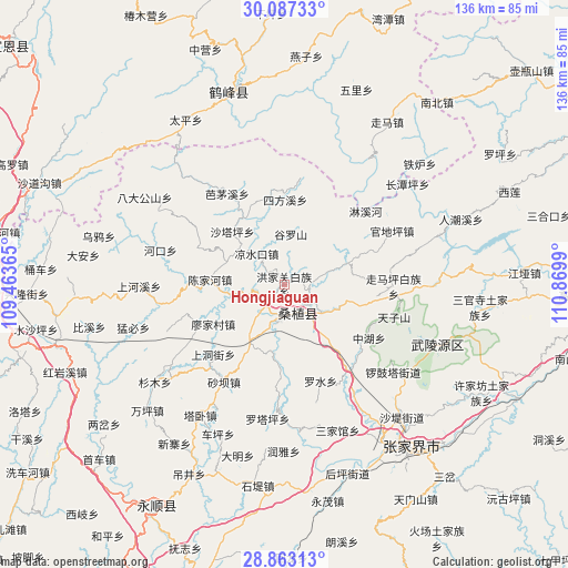
Hongjiaguan GPS coordinates[2]
29° 28' 37.488" North, 110° 10' 0.372" East
| Map corner | latitude | longitude |
|---|---|---|
| Upper-left | 30.08733°, | 109.46365° |
| Center: | 29.47708°, | 110.16677° |
| Lower-right: | 28.86313°, | 110.8699° |
| Map W x H: | 136.1×136.1 km | = 84.6×84.6mi |
| max Lat: | 53.31946° ⇑59.9% North |
| Hongjiaguan: | 29.47708° |
| min Lat: | ⇓40.1% South 18.22056° |
| min Long | Hongjiaguan | max Long |
| 75.07348° | 110.16677° | 134.28917° |
| W 29.5%⇐ | ⇒70.5% E |
Elevation
Elevation of Hongjiaguan is 290 m = 951 ft, and this is 194.8 m = 639 ft below average elevation for this country.
| Max E: |
5622 m = 18445 ft | 37.5% |
| Avg. | 484.8 m = 1591 ft | |
| Hongjiaguan | 290 m = 951 ft | |
Min E: |
-3 m = -10 ft | 62.5% |
See also: China elevation on elevation.city.
Geographical zone
Hongjiaguan is located in North temperate zone (between Tropic of Cancer and the Arctic Circle). Distance of this Northern Tropic circle is 671.6 km =417.3 mi to South.| Distance of | km | miles | from Hongjiaguan |
|---|---|---|---|
| North Pole | 6729.5 | 4181.5 | to North |
| Arctic Circle | 4123.6 | 2562.3 | to North |
| Tropic Cancer | 671.6 | 417.3 | to South |
| Equator | 3277.5 | 2036.5 | to South |


Nearby cities:
15 places around Hongjiaguan: (largest is in red/bold)
• Chenjiahe
18.4 km =11.4 mi,  273°
273°
• Furongqiao
13.5 km =8.4 mi,  72°
72°
• Guluoshan
12.6 km =7.8 mi,  11°
11°
• Kongkeshu
17.7 km =11 mi,  103°
103°
• Lianghekou
13.9 km =8.6 mi,  258°
258°
• Liangshuikou
9.9 km =6.2 mi,  316°
316°
• Lifuta
17.3 km =10.7 mi,  211°
211°
• Liyuan
9.1 km =5.7 mi,  186°
186°
• Maidiping
18.6 km =11.6 mi,  85°
85°
• Qiaotou
18.3 km =11.4 mi,  142°
142°
• Ruishi
11.6 km =7.2 mi,  124°
124°
• Shataping
17.5 km =10.9 mi,  314°
314°
• Xiaobutou
6.9 km =4.3 mi,  254°
254°
• Zhangjiaqiao
4.1 km =2.5 mi, 324°
• Zhujita
5.7 km =3.5 mi, 100°
Sources, notices
• [Note1] Compared only with cities in China existing in our database
• [Src1] Map data: © OpenStreetMap contributors (CC-BY-SA)
• [Src2] Other city data from geonames.org with taken over terms of usage.
• [Src3] Geographical zone / Annual Mean Temperature by Robert A. Rohde @ Wikipedia
