Liuyin geodata
Liuyin (Chongqing) is a seat of a fourth-order administrative division; located in China in Asia/Shanghai (GMT+8) time zone. In our database, there are 1268 cities with bigger population. Compared to other cities in China, 54.4% of cities are located further ↑North; 84.8% of cities are located further →East and 63.4% of cities have lower elevation than Liuyin. Note1


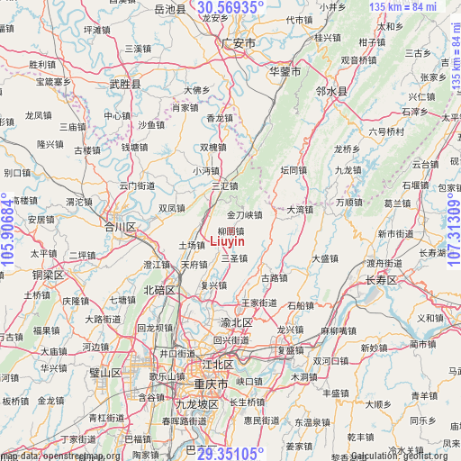
Liuyin GPS coordinates[2]
29° 57' 43.452" North, 106° 36' 35.856" East
| Map corner | latitude | longitude |
|---|---|---|
| Upper-left | 30.56935°, | 105.90684° |
| Center: | 29.96207°, | 106.60996° |
| Lower-right: | 29.35105°, | 107.31309° |
| Map W x H: | 135.5×135.5 km | = 84.2×84.2mi |
| max Lat: | 53.31946° ⇑54.4% North |
| Liuyin: | 29.96207° |
| min Lat: | ⇓45.6% South 18.22056° |
| min Long | Liuyin | max Long |
| 75.07348° | 106.60996° | 134.28917° |
| W 15.2%⇐ | ⇒84.8% E |
Elevation
Elevation of Liuyin is 303 m = 994 ft, and this is 181.8 m = 596 ft below average elevation for this country.
| Max E: |
5622 m = 18445 ft | 36.6% |
| Avg. | 484.8 m = 1591 ft | |
| Liuyin | 303 m = 994 ft | |
Min E: |
-3 m = -10 ft | 63.4% |
See also: China elevation on elevation.city.
Geographical zone
Liuyin is located in North temperate zone (between Tropic of Cancer and the Arctic Circle). Distance of this Northern Tropic circle is 725.6 km =450.9 mi to South.| Distance of | km | miles | from Liuyin |
|---|---|---|---|
| North Pole | 6675.6 | 4148 | to North |
| Arctic Circle | 4069.7 | 2528.8 | to North |
| Tropic Cancer | 725.6 | 450.9 | to South |
| Equator | 3331.5 | 2070.1 | to South |


Nearby cities:
15 places around Liuyin: (largest is in red/bold)
• Cizhu
12.8 km =8 mi,  78°
78°
• Dongyang
21 km =13 mi,  226°
226°
• Fuxing
16.7 km =10.4 mi,  197°
197°
• Gulu
18.7 km =11.6 mi,  136°
136°
• Jindaoxia
6.3 km =3.9 mi,  40°
40°
• Jingguan
8.6 km =5.3 mi,  210°
210°
• Mu’er
17.7 km =11 mi,  169°
169°
• Qingping
8.8 km =5.5 mi,  280°
280°
• Sanhui
13.4 km =8.3 mi,  352°
352°
• Shitan
15.7 km =9.8 mi,  319°
319°
• Shuangfeng
18.7 km =11.6 mi,  291°
291°
• Tianfu
14.6 km =9.1 mi, 227°
• Tuchang
12.2 km =7.6 mi,  250°
250°
• Xiaomian
19.3 km =12 mi,  337°
337°
• Xinglong
12.3 km =7.6 mi,  131°
131°
Sources, notices
• [Note1] Compared only with cities in China existing in our database
• [Src1] Map data: © OpenStreetMap contributors (CC-BY-SA)
• [Src2] Other city data from geonames.org with taken over terms of usage.
• [Src3] Geographical zone / Annual Mean Temperature by Robert A. Rohde @ Wikipedia
