Lingbei geodata
Lingbei (Jiangxi) is a seat of a fourth-order administrative division; located in China in Asia/Shanghai (GMT+8) time zone. In our database, there are 1268 cities with bigger population. Compared to other cities in China, 82.1% of cities are located further ↑North; 56.8% of cities are located further ←West and 55.7% of cities have higher elevation than Lingbei. Note1


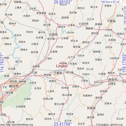
Lingbei GPS coordinates[2]
26° 3' 3.744" North, 115° 28' 0.804" East
| Map corner | latitude | longitude |
|---|---|---|
| Upper-left | 26.68102°, | 114.76377° |
| Center: | 26.05104°, | 115.46689° |
| Lower-right: | 25.41766°, | 116.17002° |
| Map W x H: | 140.5×140.5 km | = 87.3×87.3mi |
| max Lat: | 53.31946° ⇑82.1% North |
| Lingbei: | 26.05104° |
| min Lat: | ⇓17.9% South 18.22056° |
| min Long | Lingbei | max Long |
| 75.07348° | 115.46689° | 134.28917° |
| W 56.8%⇐ | ⇒43.2% E |
Elevation
Elevation of Lingbei is 126 m = 413 ft, and this is 358.8 m = 1177 ft below average elevation for this country.
| Max E: |
5622 m = 18445 ft | 55.7% |
| Avg. | 484.8 m = 1591 ft | |
| Lingbei | 126 m = 413 ft | |
Min E: |
-3 m = -10 ft | 44.3% |
See also: China elevation on elevation.city.
Geographical zone
Lingbei is located in North temperate zone (between Tropic of Cancer and the Arctic Circle). Distance of this Northern Tropic circle is 290.7 km =180.6 mi to South.| Distance of | km | miles | from Lingbei |
|---|---|---|---|
| North Pole | 7110.5 | 4418.3 | to North |
| Arctic Circle | 4504.6 | 2799 | to North |
| Tropic Cancer | 290.7 | 180.6 | to South |
| Equator | 2896.6 | 1799.9 | to South |


Nearby cities:
15 places around Lingbei: (largest is in red/bold)
• Chexi
11.4 km =7.1 mi,  91°
91°
• Fenkeng
21.6 km =13.4 mi,  66°
66°
• Gongjiang
11.9 km =7.4 mi,  208°
208°
• Huanglin
21.4 km =13.3 mi,  133°
133°
• Jiecun
18.9 km =11.7 mi,  350°
350°
• Kuantian
20.5 km =12.7 mi,  106°
106°
• Longkou
22.3 km =13.9 mi,  312°
312°
• Luo’ao
21.7 km =13.5 mi,  233°
233°
• Ma’an
19.3 km =12 mi,  24°
24°
• Sanxixiang
17.6 km =10.9 mi,  288°
288°
• Shefu
16.5 km =10.3 mi,  321°
321°
• Xianxia
11.8 km =7.3 mi,  54°
54°
• Xinbei
23 km =14.3 mi, 211°
• Yinkeng
23.5 km =14.6 mi,  38°
38°
• Zishan
12.6 km =7.8 mi,  143°
143°
Sources, notices
• [Note1] Compared only with cities in China existing in our database
• [Src1] Map data: © OpenStreetMap contributors (CC-BY-SA)
• [Src2] Other city data from geonames.org with taken over terms of usage.
• [Src3] Geographical zone / Annual Mean Temperature by Robert A. Rohde @ Wikipedia
